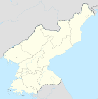
Haeju Airport
Appearance
Haeju Airport 해주공항 | |||||||||||
|---|---|---|---|---|---|---|---|---|---|---|---|
| Summary | |||||||||||
| Airport type | Public | ||||||||||
| Operator | Korean People's Army and Air Koryo | ||||||||||
| Location | Haeju, South Hwanghae, North Korea | ||||||||||
| Elevation AMSL | 131 ft / 40 m | ||||||||||
| Coordinates | 38°00′23.60″N 125°46′43.80″E / 38.0065556°N 125.7788333°E | ||||||||||
| Runways | |||||||||||
| |||||||||||
| Haeju Airport | |
| Chosŏn'gŭl | 해주공항 |
|---|---|
| Hancha | |
| Revised Romanization | Haeju Gonghang |
| McCune–Reischauer | Haeju Konghang |
Haeju Airport is an airport located in Haeju, South Hwanghae, North Korea. Haeju Airport is controlled by the Korean People's Army. The airport mainly operates military flights but also has a limited number of civilian flights. This airport is notorious to South Korean intelligence authorities, because former North Korean Intelligence agents frequently use it as a transfer point. The single runway 12/30 is 6200x289 ft (1890x88 m).During the Korean War the USAF designated the airfield as K-19.
Airlines and destinations
| Airlines | Destinations |
|---|---|
| Air Koryo | Chongjin, Pyongyang, Wonsan |

