Hathaway, Montana
Appearance
Hathaway, Montana | |
|---|---|
| Coordinates: 46°16′34″N 106°11′48″W / 46.27611°N 106.19667°W | |
| Country | United States |
| State | Montana |
| County | Rosebud |
| Elevation | 2,441 ft (744 m) |
| Time zone | UTC-7 (Mountain (MST)) |
| • Summer (DST) | UTC-6 (MDT) |
| ZIP code | 59333 |
| Area code | 406 |
| GNIS feature ID | 772196[1] |
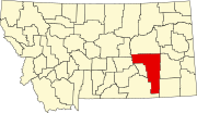
Hathaway is an unincorporated community in Rosebud County, Montana, United States. Hathaway is located at Exit 117 on Interstate 94, roughly 20 miles (32 km) west-southwest of Miles City. The community had a post office until July 29, 1995; it still has its own ZIP code, 59333.[2][3]
References
- ^ "Hathaway". Geographic Names Information System. United States Geological Survey, United States Department of the Interior.
- ^ United States Postal Service (2012). "USPS - Look Up a ZIP Code". Retrieved 2012-02-15.
- ^ "Postmaster Finder - Post Offices by ZIP Code". United States Postal Service. Retrieved July 8, 2014.


