Hidden Lake Formation
| Hidden Lake Formation | |
|---|---|
| Stratigraphic range: Coniacian-Santonian | |
| Type | Geological formation |
| Unit of | Gustav Group |
| Overlies | Whisky Bay Formation |
| Lithology | |
| Primary | Sandstone |
| Other | Siltstone |
| Location | |
| Coordinates | 63°00′S 57°00′W / 63.0°S 57.0°W |
| Approximate paleocoordinates | 63°06′S 63°54′W / 63.1°S 63.9°W |
| Region | James Ross Island, James Ross Island group |
| Country | Antarctica |
| Type section | |
| Named for | Hidden Lake |
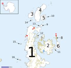
 Map of James Ross Island group James Ross Island is number 2 | |
The Hidden Lake Formation is a Late Cretaceous geologic formation in Antarctica. The sandstones and siltstones of the formation were deposited in a deltaic environment.
Intederminate megalosaur remains have been recovered from it.[1] Also many plant fossils and ichnofossils of Planolites sp. and Palaeophycus sp. have been found in the formation.[2]
See also
References
- ^ Weishampel, et al. (2004). "Dinosaur distribution" Pp. 517-607. in Weishampel, David B.; Dodson, Peter; and Osmólska, Halszka (eds.): The Dinosauria, 2nd, Berkeley: University of California Press. 861 pp. ISBN 0-520-24209-2. " Pp. 517-607.
- ^ Hidden Lake at Fossilworks.org
Further reading
- V. D. Barreda, S. Palamarczuk, and F. Medina. 1999. Palinología de la Formación Hidden Lake (Coniaciano-Santoniano), Isla James Ross, Antártida. Revista Española de Micropaleontología (31)53-72
- R. E. Molnar, A. L. Angriman, and Z. Gasparini. 1996. An Antarctic Cretaceous theropod. Memoirs of the Queensland Museum 39(3):669-674
- D. Néraudeau, A. Crame, and M. Kooser. 2000. Upper Cretaceous echinoids from James Ross Basin, Antarctica. Géobios 33(4):455-466
