High Forest, Minnesota
Appearance
High Forest | |
|---|---|
| Coordinates: 43°50′46″N 92°32′59″W / 43.84611°N 92.54972°W | |
| Country | United States |
| State | Minnesota |
| County | Olmsted |
| Township | High Forest Township |
| Area | |
| • Total | 0.33 sq mi (0.85 km2) |
| • Land | 0.33 sq mi (0.85 km2) |
| • Water | 0.00 sq mi (0.00 km2) |
| Elevation | 1,240 ft (380 m) |
| Population (2020) | |
| • Total | 126 |
| • Density | 386.50/sq mi (149.07/km2) |
| Time zone | UTC-6 (Central (CST)) |
| • Summer (DST) | UTC-5 (CDT) |
| ZIP code | 55976 |
| Area code | 507 |
| GNIS feature ID | 2806362[2] |
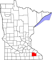
High Forest is an unincorporated community in High Forest Township, Olmsted County, Minnesota, United States, near Rochester and Stewartville. The community is located near the junction of Olmsted County Roads 6 and 8, and Covill Street SW.
History
[edit]High Forest was platted in 1855, and named for the forests near the original town site.[3] A post office was established at High Forest in 1856, and remained in operation until 1902.[4]
| Census | Pop. | Note | %± |
|---|---|---|---|
| 1870 | 249 | — | |
| 1880 | 180 | −27.7% | |
| 1890 | 163 | −9.4% | |
| 1900 | 139 | −14.7% | |
| 1910 | 127 | −8.6% | |
| 2020 | 126 | — | |
| U.S. Decennial Census[5] | |||
References
[edit]- ^ "2020 U.S. Gazetteer Files". United States Census Bureau. Retrieved July 24, 2022.
- ^ a b U.S. Geological Survey Geographic Names Information System: High Forest, Minnesota
- ^ Upham, Warren (1920). Minnesota Geographic Names: Their Origin and Historic Significance. Minnesota Historical Society. p. 386.
- ^ "Olmsted County". Jim Forte Postal History. Retrieved July 27, 2015.
- ^ United States Census Bureau. "Census of Population and Housing". Archived from the original on May 7, 2015.


