Jayaprithvi
Appearance
Jayaprithvi Municipality
जयपृथ्वी नगरपालिका Chainpur | |
|---|---|
| Coordinates: 29°33′N 81°12′E / 29.550°N 81.200°E | |
| Country | |
| Zone | Seti Zone |
| District | Bajhang District |
| Time zone | UTC+5:45 (NST) |
| Postal code | 10500 |
| Area code | 092 |
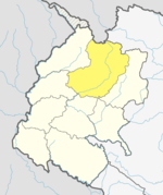
Jayaprithvi (ancient name Chainpur[citation needed]) is a municipality and the district headquarter of Bajhang District in Province No. 7 of Nepal that was established on 18 May 2014 by merging the two former Village development committees Rithapata, Chainpur, Hemantabada, Luyanta and Subeda.[1][2] It lies on the bank of Seti River. At the time of the 2011 Nepal census it had a population of 22,191 people living in 4,015 individual households.[3]
Transportation
Bajhang Airport lies in Old-Rithapata.[4]
References
- ^ "72 new municipalities announced". My Republica.com. Archived from the original on 2014-06-18. Retrieved 2014-06-10.
{{cite web}}: Unknown parameter|deadurl=ignored (|url-status=suggested) (help) - ^ "Government announces 72 new municipalities". The Kathmandu Post. Retrieved 2014-06-10.
- ^ "National Population and Housing Census 2011" (PDF). Central Bureau of Statistics. November 2017. Retrieved 1 May 2018.
- ^ "Bajhang Airport" (PDF). Civil Aviation Authority of Nepal. Retrieved 1 May 2018.


