
Jizerní Vtelno
Jizerní Vtelno | |
|---|---|
Municipality and village | |
 | |
| Country | |
| Region | Central Bohemian Region |
| District | Mladá Boleslav District |
| Area | |
| • Total | 2.67 sq mi (6.92 km2) |
| Elevation | 823 ft (251 m) |
| Population (2006) | |
| • Total | 351 |
| Time zone | UTC+1 (CET) |
| • Summer (DST) | UTC+2 (CEST) |
| Post code | 294 31 |
Jizerní Vtelno is a village and municipality in Mladá Boleslav District in the Central Bohemian Region of the Czech Republic. It is located 6 kilometres (3.7 mi) southwest of Mladá Boleslav and 44 kilometres (27 mi) northeast of Prague.
The municipality covers an area of 6.92 square kilometres (2.67 sq mi) and as of 2006 it had a population of 351. First written notice about the village is from year 1229.
Gallery
-
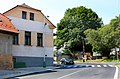 Municipal office
 -
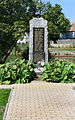 World War I memorial
 -
 Old farm


References
- This article was initially translated from the Czech Wikipedia.
Wikimedia Commons has media related to Jizerní Vtelno.
50°22′N 14°51′E / 50.367°N 14.850°E