Kew, Merseyside
| Kew | |
|---|---|
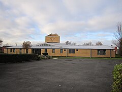
 Church of St. Francis of Assisi | |
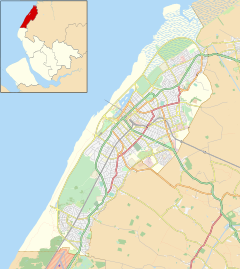
Location within Merseyside | |
| Metropolitan borough | |
| Metropolitan county | |
| Region | |
| Country | England |
| Sovereign state | United Kingdom |
| Post town | SOUTHPORT |
| Postcode district | PR8 |
| Dialling code | 01704 |
| Police | Merseyside |
| Fire | Merseyside |
| Ambulance | North West |
| UK Parliament | |
Kew is a suburb of Southport, a seaside town in Sefton, Merseyside, England. It makes up the south eastern edge of the town, bordering Scarisbrick. It is a middle class area of mostly modern development, and one of Southport's smallest suburbs.
The area was originally a 12-acre garden & zoological site in the 1880s, named after Kew Gardens in Surrey. Visitors to the Town would travel via horse tram to enjoy the gardens, pavilion & lake which had gondoliers. Parts of the lake & gardens still survive. Modern day Kew is a mid-late 20th century housing estate close to the Hospital which was built on Blowick Moss & also former playing fields. The roads are mainly named after horse racing venues & the area includes a small shopping area, a primary school (Kew Woods) & a pub named The Pageant.
Kew Gardens railway station was on the Liverpool, Southport and Preston Junction Railway from 1 November 1887 to 26 September 1938.[1]
References
- ^ Butt, R. V. J. (October 1995). The Directory of Railway Stations: details every public and private passenger station, halt, platform and stopping place, past and present (1st ed.). Sparkford: Patrick Stephens Ltd. p. 131. ISBN 978-1-85260-508-7. OCLC 60251199. OL 11956311M.


