Kunturkanki District
Kunturkanki | |
|---|---|
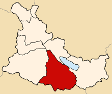
 Location of Kunturkanki in the Canas province | |
| Country | |
| Region | Cusco |
| Province | Canas |
| Founded | January 7, 1961 |
| Capital | El Descanso |
| Government | |
| • Mayor | Valerio Pacuala Huillca (2007) |
| Area | |
| • Total | 376.19 km2 (145.25 sq mi) |
| Elevation | 3,940 m (12,930 ft) |
| Population | |
| • Total | 6,256 |
| • Density | 17/km2 (43/sq mi) |
| Time zone | UTC-5 (PET) |
| UBIGEO | 080503 |
Kunturkanki District is one of eight districts in the Canas Province in Peru. Its seat is the village of El Descanso.
Ethnic groups
The people in the district are mainly indigenous citizens of Quechua descent. Quechua is the language which the majority of the population (89.61%) learnt to speak in childhood, 10.26% of the residents started speaking using the Spanish language (2007 Peru Census).[1]
See also
References
- ^ inei.gob.pe INEI, Peru, Censos Nacionales 2007, Frequencias: Preguntas de Población
