Lönsboda
Appearance
Lönsboda | |
|---|---|
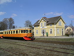
 Lönsboda railway station | |
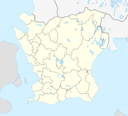
| Coordinates: 56°24′N 14°19′E / 56.400°N 14.317°E | |
| Country | Sweden |
| Province | Scania |
| County | Scania County |
| Municipality | Osby Municipality |
| Area | |
| • Total | 2.28 km2 (0.88 sq mi) |
| Population (31 December 2010)[1] | |
| • Total | 1,903 |
| • Density | 834/km2 (2,160/sq mi) |
| Time zone | UTC+1 (CET) |
| • Summer (DST) | UTC+2 (CEST) |
| Postal codes | 280 70; 283 93 |
Lönsboda is the second largest locality in Osby Municipality, Scania County, Sweden with 1,903 inhabitants in 2010.[1]
Lönsboda is situated in north-eastern Scania, about 20 km east of the municipal seat Osby and near the region border to Blekinge and Kronoberg.
The community grew up around a railway station which was opened in 1901.
United States Marine Corps War Memorial
[edit]Lönsboda has a connection to the United States and its military history. Sculptors obtained a block of black diabase for the pedestal of the Marine Corps War Memorial from quarries in Lönsboda.
References
[edit]- ^ a b c "Tätorternas landareal, folkmängd och invånare per km2 2005 och 2010" (in Swedish). Statistics Sweden. 14 December 2011. Archived from the original on 27 January 2012. Retrieved 10 January 2012.


