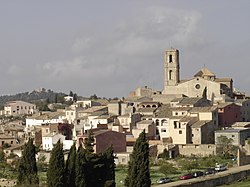
La Figuera
La Figuera | |
|---|---|
 | |
| Coordinates: 41°13′4″N 0°43′56″E / 41.21778°N 0.73222°E | |
| Country | |
| Community | |
| Province | Tarragona |
| Comarca | Priorat |
| Government | |
| • Mayor | Josep Maria Porqueres Giral (2015)[1] |
| Area | |
| • Total | 18.7 km2 (7.2 sq mi) |
| Elevation | 575 m (1,886 ft) |
| Population (2014)[1] | |
| • Total | 118 |
| • Density | 6.3/km2 (16/sq mi) |
| Demonym(s) | Figuerenc, figuerenca |
| Website | www |
La Figuera it is a town of Priorat, in Catalonia, with an altitude of 575 m that allow us to enjoy a privileged sight on the region from the "Balcony of the Priorat" and from the "Guixà". Moreover, from the hermitage of Sant Pau it is said that lands of seven provinces can be seen. The extension of the term is 18.75 km² and vineyard and olive tree predominates.
References
- ^ a b "Ajuntament de la Figuera". Generalitat of Catalonia. Retrieved 2015-11-13.
- ^ "El municipi en xifres: La Figuera". Statistical Institute of Catalonia. Retrieved 2015-11-23.
External links


