Le Mont-Dore (New Caledonia)
Appearance
This article needs additional citations for verification. (September 2015) |
Le Mont-Dore | |
|---|---|
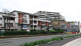
 The High Street, Le Mont-Dore | |
 Location of the commune (in red) within New Caledonia | |
| Coordinates: 22°12′57″S 166°27′59″E / 22.2157°S 166.4665°E | |
| Country | France |
| Sui generis collectivity | New Caledonia |
| Province | South Province |
| Government | |
| • Mayor | Éric Gay |
| Area 1 | 643.0 km2 (248.3 sq mi) |
| Population (2014 census) | 27,155 |
| • Density | 42/km2 (110/sq mi) |
| Ethnic distribution | |
| • 1996 census | Europeans 39.7% Polynesians 28.6% Kanaks 19.1% Other 12.6% |
| Time zone | UTC+11:00 |
| INSEE/Postal code | 98817 /98809 |
| Elevation | 0–825 m (0–2,707 ft) (avg. 20 m or 66 ft) |
| 1 New Caledonia Land Register (DITTT) data, which exclude lakes and ponds larger than 1 km² (0.386 sq mi or 247 acres) as well as the estuaries of rivers. | |
Le Mont-Dore is a commune in the suburbs of Nouméa in the South Province of New Caledonia, an overseas territory of France[1] in the Pacific Ocean.
See also
Wikimedia Commons has media related to Le Mont-Dore (Nouvelle-Calédonie).
- Réginald Bernut, a local politician
References
- ^ Commune du Mont-Doré : http://www.mont-dore.nc/.
{{cite web}}: Missing or empty|title=(help)CS1 maint: extra punctuation (link)
