
Louny District
Louny District
Okres Louny | |
|---|---|
 St Nicholas Church in Louny | |
 District location in the Ústí nad Labem Region within the Czech Republic | |
| Country | |
| Region | Ústí nad Labem Region |
| Capital | Louny |
| Area | |
| • Total | 1,117.65 km2 (431.53 sq mi) |
| Population (2009) | |
| • Total | 88,247 |
| • Density | 78.96/km2 (204.5/sq mi) |
| Time zone | UTC+1 (CET) |
| • Summer (DST) | UTC+2 (CEST) |
Louny District (Czech: Okres Louny) is one of seven districts (okres) located within the Ústí nad Labem Region (Ústecký kraj) in the Czech Republic. Its administrative center is the city of Louny.
Complete list of municipalities
Bitozeves - Blatno - Blažim - Blšany - Blšany u Loun - Brodec - Břvany - Cítoliby - Čeradice - Černčice - Deštnice - Dobroměřice - Domoušice - Holedeč - Hříškov - Hřivice - Chlumčany - Chožov - Chraberce - Jimlín - Koštice - Kozly - Krásný Dvůr - Kryry - Lenešice - Libčeves - Liběšice - Libočany - Libořice - Lipno - Lišany - Líšťany - Louny - Lubenec - Měcholupy - Nepomyšl - Nová Ves - Nové Sedlo - Obora - Očihov - Opočno - Panenský Týnec - Peruc - Petrohrad - Pnětluky - Počedělice - Podbořanský Rohozec - Podbořany - Postoloprty - Raná - Ročov - Slavětín - Smolnice - Staňkovice - Toužetín - Tuchořice - Úherce - Velemyšleves - Veltěže - Vinařice - Vrbno nad Lesy - Vroutek - Vršovice - Výškov - Zálužice - Zbrašín - Žatec - Želkovice - Žerotín - Žiželice
Municipalities

Gallery
-
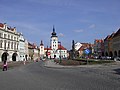 Freedom Square and Town Hall in Žatec
 -
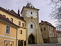 Priests' Gate in Žatec
 -

-
 Chateau in Krásný Dvůr
 -
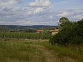 Hop gardens around village of Malá Černoc near Blšany
 -
 More-than-1000-year-old Oldřich Oak in Peruc
 -
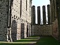
 Monastery in Ročov
 -
 Unfinished Gothic church in Panenský Týnec
 -
-
 Mysterious Stone lines of Kounov
 -
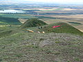 Paragliding on slopes of Mt. Raná in České středohoří
 -
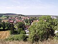
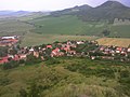 Village of Raná as seen from Mt. Raná


