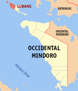
Lubang, Occidental Mindoro
Lubang | |
|---|---|
| Municipality of Lubang | |
 Cabra Island Lighthouse | |
 Map of Occidental Mindoro with Lubang highlighted | |
Location within the Philippines | |
| Coordinates: 13°51′31″N 120°07′22″E / 13.8586°N 120.1228°E | |
| Country | |
| Region | Mimaropa |
| Province | Occidental Mindoro |
| District | Lone District |
| Barangays | 16 (see Barangays) |
| Government | |
| • Type | Sangguniang Bayan |
| • Mayor | Roberto Sanchez |
| • Electorate | 13,799 voters (2022) |
| Area | |
| • Total | 113.10 km2 (43.67 sq mi) |
| Population (2020 census)[3] | |
| • Total | 17,437 |
| • Density | 150/km2 (400/sq mi) |
| Time zone | UTC+8 (PST) |
| ZIP code | 5109 |
| PSGC | |
| IDD : area code | +63 (0)43 |
| Income class | 4th municipal income class |
| Revenue (₱) | ₱ 125 million (2020) |
| Native languages | Tagalog |
Lubang, officially the Municipality of Lubang, is a 4th class municipality in the province of Occidental Mindoro, Philippines. According to the 2020 census, it has a population of 17,437 people.[3]
The municipality encompasses the north-western half of Lubang Island, as well as Cabra Island. The municipality of Lubang is part of the Lubang Island Group, which constitutes 7 islands that are geographically distinct from any landmasses, making the island group biologically unique - and endangered at the same time. The islands are under consideration to be set as a UNESCO tentative site due to its geographic importance, biological diversity, and intact rainforests.[4]
Barangays
Lubang is politically subdivided into 16 barangays.
Demographics
|
| ||||||||||||||||||||||||||||||||||||||||||||||||
| Source: Philippine Statistics Authority[5][6][7][8] | |||||||||||||||||||||||||||||||||||||||||||||||||
Local government
The Municipality of Lubang like most, if not all of the municipalities in the Philippines elects a Municipal Mayor who deals with the executive affairs of the municipality, a Municipal Vice Mayor who oversees the Municipal Council, and members of the Municipal Council. Currently, the Mayor of Lubang is Roberto "Bobby" Sanchez and the Vice Mayor is Charles Z. Villas.
The municipality also has 10 municipal councilors, 8 of which are elected along with the Mayor and Vice Mayor while the other two are from the Federation of Sangguniang Kabataan officers and the Association of Barangay Chairmen of the municipality. Currently, the following are the councilors of the municipality:
- Anzaldo, Erwin (LP)
- Daulat, Wilbert (LP)
- Guimba, Eugenio (UNA)
- Alegre, Dante (LP)
- Tangi, Ferdie (LP)
- Tiatson, Michael Ron (IND)
- Moreno, Alma (LP)
- Agas, Orly (LP)
- (Association of Barangay Chairmen President)
The municipality, as part of the Province of Occidental Mindoro, also elects provincial government officials. Currently, the provincial government is led by Governor Mario Gene J. Mendiola and by Vice Governor Peter Alfaro.
In the House of Representatives of the Philippines, it is part of the Lone District of Occidental Mindoro currently represented by Congresswoman Josephine Y. Ramirez-Sato.
References
- ^ Municipality of Lubang | (DILG)
- ^ "Province: Occidental Mindoro". PSGC Interactive. Quezon City, Philippines: Philippine Statistics Authority. Retrieved 12 November 2016.
- ^ a b Census of Population (2020). "Mimaropa". Total Population by Province, City, Municipality and Barangay. Philippine Statistics Authority. Retrieved 8 July 2021.
- ^ https://www.researchgate.net/publication/227765006_Taxonomy_of_wild_pigs_Sus_of_the_Philippines
- ^ Census of Population (2015). "Region IV-B (Mimaropa)". Total Population by Province, City, Municipality and Barangay. Philippine Statistics Authority. Retrieved 20 June 2016.
- ^ Census of Population and Housing (2010). "Region IV-B (Mimaropa)" (PDF). Total Population by Province, City, Municipality and Barangay. National Statistics Office. Retrieved 29 June 2016.
- ^ Censuses of Population (1903–2007). "Region IV-B (Mimaropa)". Table 1. Population Enumerated in Various Censuses by Province/Highly Urbanized City: 1903 to 2007. National Statistics Office.
{{cite encyclopedia}}: CS1 maint: numeric names: authors list (link) - ^ "Province of Occidental Mindoro". Municipality Population Data. Local Water Utilities Administration Research Division. Retrieved 17 December 2016.


