
Mebane, North Carolina
Mebane, North Carolina | |
|---|---|
| Motto: "Positively Charming" | |
| Country | United States |
| State | North Carolina |
| Counties | Alamance, Orange |
| Area | |
| • Total | 8.5 sq mi (21.9 km2) |
| • Land | 8.3 sq mi (21.6 km2) |
| • Water | 0.1 sq mi (0.3 km2) |
| Elevation | 673 ft (205 m) |
| Population (2010) | |
| • Total | 11,393 |
| • Density | 1,300/sq mi (520/km2) |
| Time zone | UTC-5 (Eastern (EST)) |
| • Summer (DST) | UTC-4 (EDT) |
| ZIP code | 27302 |
| Area code | 919/984 |
| FIPS code | 37-42240[1] |
| GNIS feature ID | 1021404[2] |
Mebane /ˈmɛbən/ is a city located mostly in Alamance County, North Carolina, United States, with a part of it in Orange County, North Carolina. The town was named for General Alexander Mebane, Jr., a Revolutionary War general and member of the U.S. Congress. It was incorporated as Mebanesville in 1881 and in 1883 the name was changed to Mebane. It was incorporated as a city in 1987.[3] The population as of the 2010 census was 11,393.[4]
The Alamance County portion is part of the Burlington Metropolitan Statistical Area, which is a component of the Greensboro-Winston-Salem-High Point Combined Statistical Area. The Orange County portion is part of the Durham-Chapel Hill Metropolitan Statistical Area, which is a component of the Raleigh-Durham-Chapel Hill Combined Statistical Area.
History
The Charles F. and Howard Cates Farm, William Cook House, Cooper School, Cross Roads Presbyterian Church and Cemetery and Stainback Store, Durham Hosiery Mill No. 15, Griffis-Patton House, Thomas Guy House, Hawfields Presbyterian Church, Henderson Scott Farm Historic District, Mebane Commercial Historic District, Old South Mebane Historic District, Paisley-Rice Log House, White Furniture Company, and Woodlawn School are listed on the National Register of Historic Places.[5][6][7][8]
In October 2014, the city council voted to adopt a new seal and slogan, replacing "A progressive community, the perfect place to call home" with "Positively Charming."[9]
Geography
Mebane is located at 36°5′45″N 79°16′15″W / 36.09583°N 79.27083°W (36.095957, -79.270861).[10] According to the United States Census Bureau, the city has a total area of 8.5 square miles (21.9 km2), of which 8.3 square miles (21.6 km2) is land and 0.12 square miles (0.3 km2), or 1.36%, is water.[11]
Demographics
| Census | Pop. | Note | %± |
|---|---|---|---|
| 1900 | 218 | — | |
| 1910 | 693 | 217.9% | |
| 1920 | 1,351 | 94.9% | |
| 1930 | 1,568 | 16.1% | |
| 1940 | 2,060 | 31.4% | |
| 1950 | 2,068 | 0.4% | |
| 1960 | 2,364 | 14.3% | |
| 1970 | 2,573 | 8.8% | |
| 1980 | 2,782 | 8.1% | |
| 1990 | 4,754 | 70.9% | |
| 2000 | 7,284 | 53.2% | |
| 2010 | 11,393 | 56.4% | |
| 2014 (est.) | 13,277 | [12] | 16.5% |
As of the census[1] of 2010, there were 11,393 people residing in the city. The population density was 1,363 people per square mile (480.7/km²). There were 5,045 housing units at an average density of 554.5 per square mile (214.2/km²). The racial makeup of the city was 73.5% White, 20.4% African American, 0.5% Native American, 1.2% Asian, 0.1% Pacific Islander, 0.2% from other races, and 2.6% from two or more races. Hispanic or Latino of any race were 6% of the population.
Telephone service
Mebane straddles the Research Triangle and the Piedmont Triad areas of North Carolina. However, a majority of the phone numbers listed for the city are in the 919/984 area code, whereas the rest of Alamance County is situated in the 336 area code (originally 910). When the decision was made to split the Triad and Triangle into separate area codes, it was decided that Mebane would stay in 919 to keep the numbers on the Orange County portion uniform with the rest of the city. 984 was then introduced as an overlay with 919.
Media
Reflecting that the city is split between two television markets, Time Warner Cable's Mebane system offers stations from both the Triad and Triangle. DirecTV, Dish Network and U-verse customers receive the Triad local feed.
Airport
Mebane is home to Hurdle Field.[14]
Education
The Alamance County portion is served by the Alamance-Burlington School System (which was created by a merger between the Alamance County School System and the Burlington City School System in 1996), while the Orange County portion is served by Orange County Schools.
The public schools in Mebane include Eastern Alamance High School, Hawfields Middle School, Woodlawn Middle School, Audrey W. Garrett Elementary School, South Mebane Elementary School, and E. M. Yoder Elementary School.
Additional public schools serving Mebane residents, all part of the Orange County School System, are Efland Cheeks Elementary School, Gravely Hill Middle School, Stanford Middle School, Orange High School, and Cedar Ridge High School.
There is one private school in Mebane, Bradford Academy, a classical Christian school started in 2008.[15]
Mebane is in within 20 miles of several notable Universities including Duke University, UNC Chapel Hill, and Elon University. North Carolina State University is just over 40 miles away.
Alamance Community College is a high-ranking two year college in Graham which is 6 miles from Mebane.
Shopping
Downtown Mebane is home to many high-end home furnishing stores, antique shops, and trendy clothing stores. The birthplace of Calamity Jane's Chalk Style Paint, Downtown also houses many services, restaurants, Reed's coffee shop, and an art gallery.
Garrett Crossing, a shopping center located in Mebane, includes a Wal-Mart Supercenter. Also, a Tanger Outlet mall is located on Arrowhead Blvd. in Mebane.
Climate
| Climate data for Mebane, North Carolina | |||||||||||||
|---|---|---|---|---|---|---|---|---|---|---|---|---|---|
| Month | Jan | Feb | Mar | Apr | May | Jun | Jul | Aug | Sep | Oct | Nov | Dec | Year |
| Mean daily maximum °F (°C) | 48 (9) |
51 (11) |
61 (16) |
71 (22) |
78 (26) |
85 (29) |
88 (31) |
87 (31) |
81 (27) |
71 (22) |
62 (17) |
52 (11) |
70 (21) |
| Daily mean °F (°C) | 38 (3) |
41 (5) |
50 (10) |
58 (14) |
67 (19) |
75 (24) |
78 (26) |
77 (25) |
70 (21) |
58 (14) |
50 (10) |
41 (5) |
59 (15) |
| Mean daily minimum °F (°C) | 27 (−3) |
28 (−2) |
37 (3) |
45 (7) |
55 (13) |
64 (18) |
67 (19) |
66 (19) |
58 (14) |
47 (8) |
38 (3) |
30 (−1) |
47 (8) |
| Average precipitation inches (mm) | 3.5 (89) |
3.6 (91) |
3.9 (99) |
3.1 (79) |
4.3 (110) |
4.3 (110) |
4.6 (120) |
4.3 (110) |
3.6 (91) |
3.3 (84) |
3.1 (79) |
3.5 (89) |
45.1 (1,151) |
| [citation needed] | |||||||||||||
References
- ^ a b "American FactFinder". United States Census Bureau. Retrieved 2011-05-14.
- ^ "US Board on Geographic Names". United States Geological Survey. 2007-10-25. Retrieved 2008-01-31.
- ^ "The History of the City of Mebane". City of Mebane. Retrieved 4 January 2012.
- ^ "Profile of General Population and Housing Characteristics: 2010 Demographic Profile Data (DP-1): Mebane city, North Carolina". U.S. Census Bureau, American Factfinder. Retrieved July 30, 2012.
- ^ "National Register Information System". National Register of Historic Places. National Park Service. July 9, 2010.
- ^ "National Register of Historic Places Listings". Weekly List of Actions Taken on Properties: 12/19/11 through 12/23/11. National Park Service. 2011-12-30.
- ^ "National Register of Historic Places Listings". Weekly List of Actions Taken on Properties: 12/16/13 through 12/20/13. National Park Service. 2013-12-27.
- ^ "National Register of Historic Places Listings". Weekly List of Actions Taken on Properties: 12/27/10 through 12/30/10. National Park Service. 2011-01-07.
- ^ "Mebane unveils new city seal". The Times News. 2011-10-08.
- ^ "US Gazetteer files: 2010, 2000, and 1990". United States Census Bureau. 2011-02-12. Retrieved 2011-04-23.
- ^ "Geographic Identifiers: 2010 Demographic Profile Data (G001): Mebane city, North Carolina". U.S. Census Bureau, American Factfinder. Retrieved July 30, 2012.
- ^ "Annual Estimates of the Resident Population for Incorporated Places: April 1, 2010 to July 1, 2014". Retrieved June 4, 2015.
- ^ "Census of Population and Housing". Census.gov. Retrieved June 4, 2015.
- ^ http://www.airport-data.com/airport/4W7/
- ^ http://bradfordacademy.org/
External links
Municipalities and communities of Alamance County, North Carolina, United States | ||
|---|---|---|
| Cities | 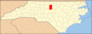 | |
| Towns | ||
| Village | ||
| CDPs | ||
| Other communities | ||
| Footnotes | ‡This populated place also has portions in an adjacent county or counties | |
Municipalities and communities of Orange County, North Carolina, United States | ||
|---|---|---|
| Cities |  | |
| Towns | ||
| CDPs | ||
| Unincorporated communities | ||
| Footnotes | ‡This populated place also has portions in an adjacent county or counties | |