
Melia, Nebraska
Melia | |
|---|---|
 West on Melia Road overlooking the Platte River | |
 Melia Location within the state of Nebraska | |
| Coordinates: 41°05′46″N 96°16′32″W / 41.09611°N 96.27556°W | |
| Country | United States |
| State | Nebraska |
| County | Sarpy |
| Elevation | 1,132 ft (345 m) |
| Time zone | UTC-6 (Central (CST)) |
| • Summer (DST) | UTC-5 (CDT) |
| ZIP codes | 68028 |
| GNIS feature ID | 835379 |
Melia is an unincorporated community in Sarpy County, Nebraska, in the United States.[1]
Melia was named in honor of an early settler. It was a station on the Chicago, Burlington, and Quincy Railroad.[2]
References
- ^ U.S. Geological Survey Geographic Names Information System: Melia, Nebraska
- ^ Fitzpatrick, Lillian L. (1960). Nebraska Place-Names. University of Nebraska Press. p. 125. ISBN 0-8032-5060-6. A 1925 edition is available for download at University of Nebraska—Lincoln Digital Commons.
Municipalities and communities of Sarpy County, Nebraska, United States | ||
|---|---|---|
| Cities | 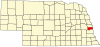 | |
| CDPs | ||
| Other communities | ||
This Nebraska state location article is a stub. You can help Wikipedia by expanding it. |