Monclova International Airport
Appearance
Venustiano Carranza International Airport Aeropuerto Internacional Venustiano Carranza | |||||||||||||||
|---|---|---|---|---|---|---|---|---|---|---|---|---|---|---|---|
| Summary | |||||||||||||||
| Airport type | Public | ||||||||||||||
| Operator | Administradora Coahuilense de Infraestructura y Transporte Aéreo | ||||||||||||||
| Location | Monclova | ||||||||||||||
| Elevation AMSL | 1,864 ft / 568 m | ||||||||||||||
| Coordinates | 26°57′21″N 101°28′12″W / 26.95583°N 101.47000°W | ||||||||||||||
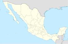
| Map | |||||||||||||||
| Runways | |||||||||||||||
| |||||||||||||||
| Statistics (2015) | |||||||||||||||
| |||||||||||||||
Source: Dirección General de Aeronáutica Civil | |||||||||||||||
Venustiano Carranza International Airport (IATA: LOV, ICAO: MMMV) is an international airport located at Frontera, Coahuila, Mexico. It handles national and international air traffic for the metropolitan area of Monclova and Frontera.
It handled 154 passengers in 2014, and 381 passengers in 2015.
The airport is named after Mexican President Venustiano Carranza.

