Morocco–Spain border
Appearance
| Morocco–Spain border | |
|---|---|
 The border, as seen on the map | |
| Characteristics | |
| Entities | |
| Length | 15.9 km |
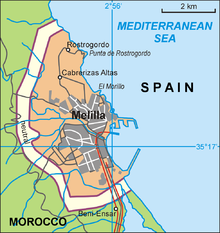
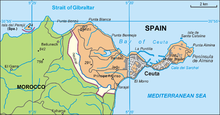
The Morocco–Spain border is located along the Plazas de soberanía, Ceuta, Melilla, and Alborán Island along the north coast of Morocco.
Between Morocco and Ceuta is a physical border known as the Ceuta border fence, Melilla also has a physical border known as the Melilla border fence


Maritime borders
Morocco and Spain also share a maritime border in the Canary island area and along the Strait of Gibraltar and the Alboran Sea. The shortest distance between land along the Strait of Gibraltar is 14.3 kilometres (8.9 mi; 7.7 nmi). The British area of Gibraltar is located on the northern coast of this strait.
Important treaties
- Treaty of Algeciras signed in April 1906
