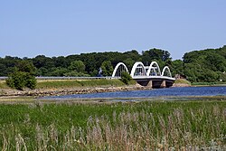
Munkholm Bridge
This article needs additional citations for verification. (February 2024) |
Munkholm Bridge | |
|---|---|
 | |
| Coordinates | 55°40′25″N 11°48′44″E / 55.673667°N 11.812223°E |
| Carries | Road |
| Crosses | Ise Fjord |
| Locale | Denmark |
| Characteristics | |
| Total length | 114 metres |
| History | |
| Construction end | 1951 |
| Opened | 1952 |
| Location | |
 | |
Munkholm Bridge (Danish: Munkholmbroen) is a 114 metres long arch bridge across the Ise Fjord linking the Holbæk area (Holbæk Municipality) with the Hornsherred peninsula (Lejre Municipality).[1] The bridge is located six kilometers from the bottom of the inlet. It was completed in 1951 and inaugurated in 1952.
See also[edit]
References[edit]
- ^ En By og dens egn (in Danish). A/S Hotaco (Strube). 1968.
55°40′25″N 11°48′44″E / 55.6736°N 11.8122°E
