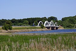
Munkholm Bridge
Appearance
Storstrøm Bridge | |
|---|---|
 | |
| Coordinates | 55°40′25″N 11°48′44″E / 55.673667°N 11.812223°E |
| Carries | Road |
| Crosses | Ise Fjord |
| Locale | Denmark |
| Characteristics | |
| Total length | 114 metres |
| History | |
| Construction end | 1951 |
| Opened | 1952 |
| Location | |
 | |
Munkholm Bridge (Template:Lang-da) is a 114 metres long arch bridge across the Ise Fjord linking the Holbæk area (Holbæk Municipality) with the Hornsherred peninsula (Lejre Municipality). The bridge is located six kilometers from the bottom of the inlet. It was completed in 1951 and inaugurated in 1952.
