Nam District, Busan
Nam
남구 | |
|---|---|
| Korean transcription(s) | |
| • Hanja | 南區 |
| • Revised Romanization | Nam-gu |
| • McCune-Reischauer | Nam-ku |
 | |
 | |
| Country | South Korea |
| Region | Yeongnam |
| Provincial level | Busan |
| Administrative divisions | 19 administrative dong |
| Area | |
• Total | 25.91 km2 (10.00 sq mi) |
| Population ([1]) | |
• Total | 229,563 |
| • Density | 8,900/km2 (23,000/sq mi) |
| • Dialect | Gyeongsang |
| Website | Nam District Office |
Nam District (literally south district) is a gu, or district, in south central Busan, South Korea. Much of Nam-gu sticks out into the Sea of Japan (East Sea), forming a peninsula which separates Suyeong Bay from Busan Harbor. It has an area of 25.91 km².[2] Nam-gu officially became a gu of Busan in 1975. In 1995 part of Nam-gu was divided to form Suyeong-gu.
The Busan International Finance Center is located here.
Demographics
Nam-gu is home to some 300,000 people, for a population density exceeding 11,000 per square kilometer. Less than 1,000 of its inhabitants are non-Korean.[3]
Busan Subway
The Busan Subway (line 2) passes through Nam-gu, where an interchange connects it to the highway leading to the Gwangan Bridge. Four subway stations along Busan Subway (line 2) are located Nam-gu, going from Kyungsung University · Pukyong National University Station to Jigegol Station.
Geography
Nam-gu contains a total of 7 islands, all uninhabited, with a total area of only 0.3 km².[4] Among these are the Oryukdo islets which mark the entrance to Busan Harbor. The highest point of Nam-gu lies inland: the peak of Hwangnyeongsan, at 427 meters above sea level. Hwangnyeong-san also marks the point where Nam-gu's borders meet those of Yeonje-gu and Busanjin-gu.
Administrative divisions

Nam-gu is divided into 6 legal dong, which altogether comprise 19 administrative dong, as follows:
- Daeyeon-dong (6 administrative dong)
- Yongho-dong (4 administrative dong)
- Yongdang-dong
- Gamman-dong (2 administrative dong)
- Wuam-dong (2 administrative dong)
- Munhyeon-dong (4 administrative dong)
Education

A number of institutions of higher education, including 6 universities, are located in Nam-gu. It includes Pusan University of Foreign Studies, Kyungsung University, Tongmyong University, and Pukyong National University.
Universities with graduate schools
- Pusan University of Foreign Studies (PUFS)
- Pukyong National University (PKNU)
- Kyungsung University
- Tongmyong University
Other institutes of higher education
Other features
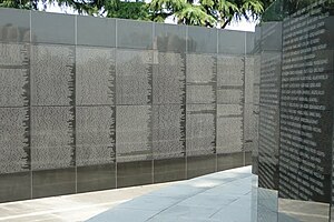
The district is home to the United Nations Memorial Cemetery, which contains graves of United Nations Command soldiers of the Korean War.
Sister city
See also
Notes
This article needs additional citations for verification. (December 2008) |
- ^ Nam-gu office population register, June 30, 2006. Nam-gu website (in korean)
- ^ Nam-gu statistical yearbook 2004, 토지와 기후 (Toji-wa Gihu) (Land and climate), table 3. Electronic version (HWP format)
- ^ Nam-gu statistical yearbook 2004, 인구 (In-gu) (Population). Electronic version (HWP format)
- ^ Nam-gu statistical yearbook 2004, 토지와 기후 (Toji-wa Gihu) (Land and climate), table 1. Electronic version (HWP format)
References
External links
- Nam-gu website Template:En icon
 Central Busan travel guide from Wikivoyage
