
New Martinsville, West Virginia
New Martinsville, West Virginia | |
|---|---|
 Location of New Martinsville, West Virginia | |
| Country | United States |
| State | West Virginia |
| County | Wetzel |
| Government | |
| • Type | Democratic |
| • Mayor | Lucille Blum |
| Area | |
| • Total | 2.71 sq mi (7.02 km2) |
| • Land | 2.67 sq mi (6.92 km2) |
| • Water | 0.04 sq mi (0.10 km2) |
| Elevation | 623 ft (190 m) |
| Population | |
| • Total | 5,366 |
| • Estimate (2011[3]) | 5,292 |
| • Density | 2,009.7/sq mi (775.9/km2) |
| Time zone | UTC-5 (Eastern (EST)) |
| • Summer (DST) | UTC-4 (EDT) |
| ZIP code | 26155 |
| Area code | 304 |
| FIPS code | 54-58684Template:GR |
| GNIS feature ID | 1544131Template:GR |

New Martinsville is a city in Wetzel County, West Virginia, United States, along the Ohio River. The population was 5,366 at the 2010 census. It is the county seat of Wetzel CountyTemplate:GR.
Geography
New Martinsville is located at 39°39′27″N 80°51′34″W / 39.65750°N 80.85944°W (39.657465, -80.859504)Template:GR.
According to the United States Census Bureau, the city has a total area of 2.71 square miles (7.02 km2), of which, 2.67 square miles (6.92 km2) is land and 0.04 square miles (0.10 km2) is water.[1]
Demographics
2010 census
As of the census[2] of 2010, there were 5,366 people, 2,340 households, and 1,477 families residing in the city. The population density was 2,009.7 inhabitants per square mile (775.9/km2). There were 2,632 housing units at an average density of 985.8 per square mile (380.6/km2). The racial makeup of the city was 98.2% White, 0.2% African American, 0.1% Native American, 0.6% Asian, 0.3% from other races, and 0.6% from two or more races. Hispanic or Latino of any race were 0.6% of the population.
There were 2,340 households out of which 25.7% had children under the age of 18 living with them, 46.8% were married couples living together, 12.1% had a female householder with no husband present, 4.2% had a male householder with no wife present, and 36.9% were non-families. 32.2% of all households were made up of individuals and 15.1% had someone living alone who was 65 years of age or older. The average household size was 2.24 and the average family size was 2.78.
The median age in the city was 46.5 years. 20.5% of residents were under the age of 18; 6.1% were between the ages of 18 and 24; 20.9% were from 25 to 44; 30.6% were from 45 to 64; and 21.7% were 65 years of age or older. The gender makeup of the city was 47.2% male and 52.8% female.
2000 census
As of the censusTemplate:GR of 2000, there were 5,984 people, 2,484 households, and 1,684 families residing in the city. The population density was 2,157.4 people per square mile (834.1/km²). There were 2,737 housing units at an average density of 986.8 per square mile (381.5/km²). The racial makeup of the city was 98.55% White, 0.05% African American, 0.10% Native American, 0.75% Asian, 0.03% Pacific Islander, 0.02% from other races, and 0.50% from two or more races. Hispanic or Latino of any race were 0.43% of the population.
There were 2,484 households out of which 28.9% had children under the age of 18 living with them, 52.6% were married couples living together, 11.7% had a female householder with no husband present, and 32.2% were non-families. 28.9% of all households were made up of individuals and 13.4% had someone living alone who was 65 years of age or older. The average household size was 2.34 and the average family size was 2.86.
In the city the population was spread out with 22.9% under the age of 18, 6.7% from 18 to 24, 25.4% from 25 to 44, 26.8% from 45 to 64, and 18.2% who were 65 years of age or older. The median age was 42 years. For every 100 females there were 88.2 males. For every 100 females age 18 and over, there were 81.5 males.
The median income for a household in the city was $33,750, and the median income for a family was $40,851. Males had a median income of $37,614 versus $21,019 for females. The per capita income for the city was $18,578. About 16.9% of families and 20.6% of the population were below the poverty line, including 29.4% of those under age 18 and 15.1% of those age 65 or over.
Political Officials
Mayor: N. Keith Nelsen
1st Ward Councilman: Holland (Holly) Grandstaff
2nd Ward Councilman: Kathryn (Kay) Goddard
3rd Ward Councilman: Chris Bauchman
4th Ward Councilman: Steve Pallisco
5th Ward Councilman: Doris Fannin
6th Ward Councilman: Iris (Deaner) Isaacs
People from New Martinsville
- Chris Booker, entertainment personality
- John Callaway, journalist
- John Murtha, Democratic Party member of the United States House of Representatives. He grew up in Pennsylvania and represented the twelfth district of that state
- Bill Stewart, former head football coach at West Virginia University
- Necro Butcher, Hardcore Wrestler
- Kristen Rae Myers, Model/Actress that claims New Martinsville is an Amish Community.
History
- First Residents: Edward Doolin about 1780.
- Name For: Presley Martin.
- Incorporated: 1838 as Martinsville, VA located in Tyler County. In 1846 Wetzel was carved out of Tyler County and the city became New Martinsville, Wetzel County, Virginia. It is the county seat of Wetzel County.
- First River Boat Service:
- Last River Boat Service:
- First Trolley Service:
- Last Trolley Service:
- Rail service: The Ohio River Rail Road 1883.
- First Bricked Streets: about 1904
- Home of Viking Glass
See also
- List of cities and towns along the Ohio River
- Lewis Wetzel
- New Martinsville Bridge
- Magnolia High School
References
- ^ a b "US Gazetteer files 2010". United States Census Bureau. Retrieved 2013-01-24.
{{cite web}}: External link in|publisher= - ^ a b "American FactFinder". United States Census Bureau. Retrieved 2013-01-24.
{{cite web}}: External link in|publisher= - ^ "Population Estimates". United States Census Bureau. Retrieved 2013-01-24.
{{cite web}}: External link in|publisher=
External links
Municipalities and communities of Wetzel County, West Virginia, United States | ||
|---|---|---|
| Cities | 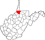 | |
| Towns | ||
| CDPs | ||
| Unincorporated communities |
| |
| Ghost towns | ||
| Footnotes | ‡This populated place also has portions in an adjacent county or counties | |