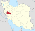
Nurabad, Lorestan
Nurabad
Persian: نورآباد | |
|---|---|
City | |
| Coordinates: 34°04′20″N 47°58′25″E / 34.07222°N 47.97361°E[1] | |
| Country | Iran |
| Province | Lorestan |
| County | Delfan |
| District | Central |
| Population (2016)[2] | |
| • Total | 65,547 |
| Time zone | UTC+3:30 (IRST) |
Nurabad (Persian: نورآباد)[a] is a city in the Central District of Delfan County, Lorestan province, Iran, serving as capital of both the county and the district.[4]
Demographics
[edit]Language and ethnicity
[edit]The city is populated by Kurds.[5] The linguistic composition of the city:[6]
Population
[edit]At the time of the 2006 National Census, the city's population was 56,404 in 12,232 households.[7] The following census in 2011 counted 61,142 people in 15,014 households.[8] The 2016 census measured the population of the city as 65,547 people in 18,607 households.[2]
Climate
[edit]Nurabad has a dry-summer continental climate(Dsa) in Köppen climate classification with precipitation being higher in winter months than summer. Summers are dry and hot with very little precipitation from June to September. Winters are very cold and relatively wet.
| Climate data for Nurabad (2000-2010, elevation:1859.1) | |||||||||||||
|---|---|---|---|---|---|---|---|---|---|---|---|---|---|
| Month | Jan | Feb | Mar | Apr | May | Jun | Jul | Aug | Sep | Oct | Nov | Dec | Year |
| Daily mean °C (°F) | −1.2 (29.8) |
1.1 (34.0) |
6.7 (44.1) |
10.4 (50.7) |
14.7 (58.5) |
20.4 (68.7) |
24.2 (75.6) |
24.2 (75.6) |
19.8 (67.6) |
14.5 (58.1) |
6.9 (44.4) |
2.1 (35.8) |
12.0 (53.6) |
| Average precipitation mm (inches) | 61.5 (2.42) |
71.5 (2.81) |
61.6 (2.43) |
74.2 (2.92) |
28.9 (1.14) |
0.5 (0.02) |
0.6 (0.02) |
0.0 (0.0) |
1.1 (0.04) |
35.8 (1.41) |
70.9 (2.79) |
72.0 (2.83) |
478.6 (18.83) |
| Source: IRIMO(temperature[9]), (precipitation[10]) | |||||||||||||
See also
[edit]Notes
[edit]References
[edit]- ^ OpenStreetMap contributors (24 August 2023). "Nurabad, Delfan County" (Map). OpenStreetMap (in Persian). Retrieved 24 August 2023.
- ^ a b "Census of the Islamic Republic of Iran, 1395 (2016)". AMAR (in Persian). The Statistical Center of Iran. p. 15. Archived from the original (Excel) on 12 October 2020. Retrieved 19 December 2022.
- ^ Nurabad, Lorestan can be found at GEOnet Names Server, at this link, by opening the Advanced Search box, entering "-3801586" in the "Unique Feature Id" form, and clicking on "Search Database".
- ^ Mousavi, Mirhossein. "Creation of Delfan County under the citizenship of Lorestan province and creation of Kakavand District". Lamtakam (in Persian). Ministry of Interior, Council of Ministers. Archived from the original on 21 January 2024. Retrieved 21 January 2024.
- ^ Fattah, Ismaïl Kamandâr (2000). Les dialectes kurdes méridionaux. Acta Iranica 37. p. vii.
- ^ "Language distribution: individual languages and language families". Iran Atlas. Retrieved 15 September 2023.
- ^ "Census of the Islamic Republic of Iran, 1385 (2006)". AMAR (in Persian). The Statistical Center of Iran. p. 15. Archived from the original (Excel) on 20 September 2011. Retrieved 25 September 2022.
- ^ "Census of the Islamic Republic of Iran, 1390 (2011)". Syracuse University (in Persian). The Statistical Center of Iran. p. 15. Archived from the original (Excel) on 19 January 2023. Retrieved 19 December 2022.
- ^ "Form 5 : Average of mean daily temperature in C. Station: Nurabad, Lorestan(40773)". Chaharmahalmet (asp). Iran Meteorological Organization. Archived from the original on 22 March 2016. Retrieved 26 March 2024.
{{cite web}}: CS1 maint: unfit URL (link) - ^ "Form 25: Monthly total of precipitation in mm. Station: Nurabad, Lorestan(40773)". Chaharmahalmet (asp). Iran Meteorological Organization. Archived from the original on 23 January 2015. Retrieved 26 March 2024.
{{cite web}}: CS1 maint: postscript (link) CS1 maint: unfit URL (link)


