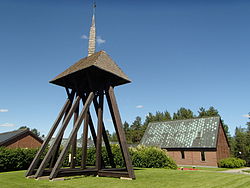
Obbola
Appearance
Obbola | |
|---|---|
 | |
| Coordinates: 63°42′N 20°19′E / 63.700°N 20.317°E | |
| Country | Sweden |
| Province | Västerbotten |
| County | Västerbotten County |
| Municipality | Umeå Municipality |
| Area | |
• Total | 2.56 km2 (0.99 sq mi) |
| Population (31 December 2010)[1] | |
• Total | 2,197 |
| • Density | 858/km2 (2,220/sq mi) |
| Time zone | UTC+1 (CET) |
| • Summer (DST) | UTC+2 (CEST) |
Obbola is a locality situated in Umeå Municipality, Västerbotten County, Sweden with 2,197 inhabitants in 2010.[1] It is located close to the town of Holmsund. Obbola lies to the west of the mouth of Ume River at the Gulf of Bothnia in the Baltic Sea. SCA is the biggest employer in the locality. In the school in Obbola there are pupils from grade one to grade nine. After that most of the pupils continue in the city of Umeå.
Obbola is connected to nearby Holmsund by the Obbola Bridge which carries the E12 road over the river estuary.
References
- ^ a b c "Tätorternas landareal, folkmängd och invånare per km2 2005 och 2010" (in Swedish). Statistics Sweden. 14 December 2011. Archived from the original on 10 January 2012. Retrieved 10 January 2012.
{{cite web}}: Unknown parameter|deadurl=ignored (|url-status=suggested) (help)
External links
![]() Media related to Obbola at Wikimedia Commons
Media related to Obbola at Wikimedia Commons


