Ouled Khodeïr District
Appearance
Ouled Khodeïr District
دائرة أولاد خضير | |
|---|---|
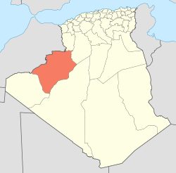
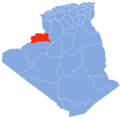
 Map of Algeria highlighting Béchar Province | |
| Country | |
| Province | Béchar |
| District seat | Ouled Khodeïr |
| Area | |
• Total | 4,140 km2 (1,600 sq mi) |
| Population (2008)[2] | |
• Total | 7,438 |
| • Density | 1.8/km2 (4.7/sq mi) |
| Time zone | UTC+01 (CET) |
| Municipalities | 2 |
Ouled Khodeïr is a district in Béchar Province, Algeria. It was named after its capital, Ouled Khodeïr. According to the 2008 census, the total population of the district was 7,438 inhabitants.[2] The Oued Saoura runs from northwest to southeast through the district, and empties into Sebkhel el Melah, also in the district, after a brief excursion into Adrar Province. The N6 national highway also runs through the district on the way from Béchar to Adrar, Algeria.
Municipalities
The district is further divided into 2 municipalities:[1]
References
- ^ a b "Dairas et Communes" (in French). Site Officiel de la Wilaya de Béchar. Retrieved 19 February 2013.
- ^ a b "Population: Béchar Wilaya" (PDF) (in French). Office National des Statistiques Algérie. Retrieved 13 February 2013.

