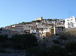
Paüls
Appearance
Paüls | |
|---|---|
 | |
| Coordinates: 40°55′27″N 0°24′01″E / 40.92417°N 0.40028°E | |
| Country | |
| Community | |
| Province | Tarragona |
| Comarca | Baix Ebre |
| Government | |
| • Mayor | Enric Adell Moragrega (2015)[1] |
| Area | |
| • Total | 43.8 km2 (16.9 sq mi) |
| Elevation | 378 m (1,240 ft) |
| Population (2014)[1] | |
| • Total | 596 |
| • Density | 14/km2 (35/sq mi) |
| Website | www |
Paüls is a municipality in the comarca of Baix Ebre, province of Tarragona, Catalonia, Spain.
The Montsagre de Paüls mountain range rises above the town.
References
- ^ a b "Ajuntament de Paüls". Generalitat of Catalonia. Retrieved 2015-11-13.
- ^ "El municipi en xifres: Paüls". Statistical Institute of Catalonia. Retrieved 2015-11-23.
External links

