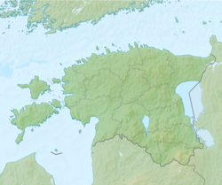
Panga, Saare County
Appearance
Panga | |
|---|---|
Village | |
| Coordinates: 58°33′38″N 22°18′49″E / 58.560556°N 22.313611°E | |
| Country | |
| County | Saare County |
| Parish | Saaremaa Parish |
| Time zone | UTC+2 (EET) |
| • Summer (DST) | UTC+3 (EEST) |
Panga is a village in Saaremaa Parish, Saare County in western Estonia.[1]
Before the administrative reform in 2017, the village was in Mustjala Parish.[2]
Close to village is a coastal cliff Panga pank.
References
- ^ "Lisa. Asustusüksuste nimistu" (PDF). haldusreform.fin.ee (in Estonian). Rahandusministeerium. Retrieved 3 December 2017.
- ^ "Saaremaa külad endiste valdade piires". www.saaremaa.ee (in Estonian). Retrieved 3 December 2017.
58°33′38″N 22°18′49″E / 58.56056°N 22.31361°E


