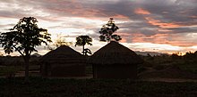
Patongo, Uganda
Patongo | |
|---|---|
| Coordinates: 02°45′36″N 33°18′36″E / 2.76000°N 33.31000°E | |
| Country | |
| Region | Northern Region of Uganda |
| Sub-region | Acholi sub-region |
| District | Agago District |
| Elevation | 1,035 m (3,396 ft) |
| Time zone | UTC+3 (EAT) |

Patongo is a town in Agago District, Acholi sub-region in the Northern Region of Uganda. The town is administered by Patongo Town Council.
Location
[edit]Patongo is approximately 21.5 kilometres (13.4 mi), by road, south of Agago, the site of the district headquarters.[1] The coordinates of the town are 2°45'36.0"N, 33°18'36.0"E (Latitude:2.7600; Longitude:33.3100).[2] Patongo lies at an average elevation of 1,035 metres (3,396 ft), above sea level.[3]
Overview
[edit]The town of Patongo was formed during the 2000s along with Pader and Pader District. Initially the location of a large camp for internally displaced people as a result of the Lord's Resistance Army insurgency, Patongo was granted town council status by the Ugandan parliament effective July 2010.[4] In 2010, when Pader District was divided to create Agago District,[5][6] Patongo went with Agago District.
Points of interest
[edit]This section needs additional citations for verification. (February 2016) |
The following additional points of interest are located within or near the town of Patongo:
- Patongo central market
- Kilak-Moroto road, going through the middle of town
- offices of Paorinher Orphanage, a non-governmental organization
- Gwoke Keni, an HIV/AIDS support group that hosts its own RootIO radio station on 103.8FM.[7]
See also
[edit]References
[edit]- ^ GFC (23 July 2015). "Road Distance Between Patongo And Agago With Map". Globefeed.com (GFC). Retrieved 23 July 2015.
- ^ "Location of Patongo, Uganda" (Map). Google Maps. Retrieved 23 July 2015.
- ^ Fallingrain.com (2018). "Elevation of Patongo, Uganda". Fallingrain.com. Retrieved 29 December 2018.
- ^ Cyprian Musoke, and Joyce Namutebi (1 September 2009). "MPS Warn On New Town Councils". New Vision. Kampala. Archived from the original on 4 September 2009. Retrieved 23 July 2015.
- ^ Vision Reporters (22 April 2010). "Government Names 14 New Districts". New Vision. Kampala. Archived from the original on 29 October 2013. Retrieved 23 July 2015.
- ^ Owot, Robert (30 March 2014). "Pader: Where Cotton Is Still A Major Earner". Daily Monitor. Kampala. Retrieved 23 July 2015.
- ^ Genrwot, Jeddy (27 May 2015). "Meet RootIO: A community radio innovation that uses a cellphone to broadcast". PC Tech Mag. Kampala. Retrieved 8 February 2016.


