Philadelphia, Missouri

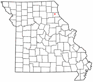
Philadelphia is an unincorporated community in western Marion County, Missouri, United States. It is located about ten miles west of Palmyra on Route 168. The community is part of the Hannibal Micropolitan Statistical Area.
Philadelphia was platted in 1835.[1] The community was named after Philadelphia, Pennsylvania.[2] A post office called Philadelphia has been in operation since 1847.[3]
39°50′19″N 91°44′21″W / 39.83861°N 91.73917°W[4]
References
- ^ "Marion County Place Names, 1928–1945". The State Historical Society of Missouri. Archived from the original on June 24, 2016. Retrieved November 3, 2016.
{{cite web}}: Unknown parameter|deadurl=ignored (|url-status=suggested) (help) - ^ Eaton, David Wolfe (1916). How Missouri Counties, Towns and Streams Were Named. The State Historical Society of Missouri. p. 193.
- ^ "Post Offices". Jim Forte Postal History. Retrieved 3 November 2016.
- ^ "Philadelphia". Geographic Names Information System. United States Geological Survey, United States Department of the Interior.

