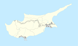
Platani, Cyprus
Appearance
Platani
| |
|---|---|
| Coordinates: 35°19′59″N 33°45′06″E / 35.33306°N 33.75167°E | |
| Country | |
| • District | Famagusta District |
| Country (controlled by) | |
| • District | Gazimağusa District |
| Population (2011)[1] | |
| • Total | 183 |
Platani (Template:Lang-el; Template:Lang-tr "place with a platanus", previously [Bladan] Error: {{Lang}}: text has italic markup (help)) is a Turkish Cypriot village in the Famagusta District of Cyprus, located 9 kilometres (5.6 mi) north of Lefkoniko. Platani is under the de facto control of Northern Cyprus. It is locally known for the nearby stalactite cave "Incirli Mağra". As of 2011, Platani had a population of 183.
References
- ^ "KKTC 2011 Nüfus ve Konut Sayımı" [TRNC 2011 Population and Housing Census] (PDF) (in Turkish). TRNC State Planning Organization. 6 August 2013.


