Portal:Derbyshire/Selected article
Selected article 1
Portal:Derbyshire/Selected article/1

Allestree is a suburb and ward of Derby, a unitary authority, in Derbyshire, England. It is the northern most ward and is situated on the A6, about two miles (3 km) north of Derby City Centre.
It was recorded in the Doomesday book as 'Adelardestreu', an outlier of the manor of Markeaton. It is bordered by the district of Amber Valley along its west and northern edges and Erewash in its north-east corner. To the south it borders the ward of Mackworth and to the east the ward of Darley Abbey.
The ward is largely residential and has two parks, Allestree park to the north and Markeaton park to the south. The ward contains parts of the village of Markeaton which at one time was a large estate containing Allestree village. The village became a parish in its own right in 1864 and was incorporated into the Borough of Derby in 1968.
Selected article 2
Portal:Derbyshire/Selected article/2

Duffield is a village, situated next to the River Derwent in Derbyshire at the lower end of the Pennines around five miles north of Derby, England. There have been humans in the area, probably, from the Iron Age. While it has been suggested that, once farming began, they would have inhabited the plains of the Derwent and Ecclesbourne, they would most likely have retreated to higher ground during the winter floods.
A few remains have been found of Anglo-Saxon occupation by a person, or persons, of some substance. The Domesday Survey records "Duvelle"" as being within the wapentake or hundred of Morleystone. In Norman times, Duffield Castle was built to protect the hunting grounds of Duffield Frith, awarded to Henry de Ferrers by William I.
Selected article 3
Portal:Derbyshire/Selected article/3

Derby School was a school in Derby in the English Midlands. It had an almost continuous history of education of over eight centuries. For most of that time it was a grammar school for boys. The school became co-educational and comprehensive in 1974 and was closed in 1989. In 1994 a new independent school called Derby Grammar School for boys was founded.
The school was re-founded in the 12th century by a local magnate, Walkelin de Derby (also called Walkelin de Ferrieres, or de Ferrers) and his wife, Goda de Toeni, who gave their own house to an Augustinian priory called Darley Abbey to be used for the school. Local legend has it that it was the second oldest school in England. However, there is no firm information as to the site of the original school.
While Derby School was in existence almost continuously for more than eight centuries, it was closed for a few years as a result of the Dissolution of the Monasteries
Following the extinction of Darley Abbey, on 21 May 1554, Queen Mary I by a Royal Charter, and in return for a payment of £260 13s 4d, granted the corporation of Derby several properties and endowments which had belonged to Darley Abbey, the College of All Saints, St Michael's Church, and some other suppressed chantries and gilds, for the foundation of "a Free Grammar School, for the instruction and education of boys and youths in the said town of Derby for ever to be maintained by the Bailiffs and Burgesses of the same town.
(More on Derby School...)
Selected article 4
Portal:Derbyshire/Selected article/4

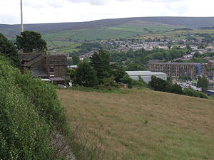
Glossop is a small market town within the High Peak borough of Derbyshire. It lies on the Glossop Brook, a tributary of the River Etherow, about 14 miles (23 km) east of Manchester, 24 miles (39 km) west of Sheffield and 30 miles (48.3 km) from Matlock. Glossop is situated near Derbyshire's county borders with Cheshire, Greater Manchester, South Yorkshire and West Yorkshire. It is between 150 and 300 metres (492 and 984 ft) above mean sea level, and uses the tagline "the gateway to the Peak District National Park". Like Buxton, it differs from other areas of the borough in that it is an unparished area, and this distinction defines its boundaries. It had a total population of over 32,000 in 2001.
Historically the name Glossop refers to the small hamlet that gave its name to an ancient parish recorded in the Domesday Book of 1086 ...
Selected article 5
Portal:Derbyshire/Selected article/5

The Peak District is an upland area in central and northern England, lying mainly in northern Derbyshire, but also covering parts of Cheshire, Greater Manchester, Staffordshire, and South and West Yorkshire.
Most of the area falls within the Peak District National Park, whose designation in 1951 made it the earliest national park in the British Isles. An area of great diversity, it is conventionally split into the northern Dark Peak, where most of the moorland is found and whose geology is gritstone, and the southern White Peak, where most of the population lives and where the geology is mainly limestone-based. Proximity to the major conurbations of the Midlands, Yorkshire and Lancashire, coupled with easy access by road and rail, make it the most visited national park in the UK.
The Peak District forms the southern end of the Pennines and much of the area is uplands above 300 m, with a high point on Kinder Scout of 636 m. Despite its name, the landscape lacks sharp peaks, being characterised by rounded hills and gritstone escarpments (the "edges"). The area is surrounded by major conurbations, including Huddersfield, Manchester, Sheffield, Derby and Stoke-on-Trent.
The National Park covers 555 square miles (1,438 km2) of Derbyshire, Staffordshire, Cheshire, Greater Manchester and South and West Yorkshire, including the majority of the area commonly referred to as the Peak. The Park boundaries were drawn to exclude large built-up areas and industrial sites from the park; in particular, the town of Buxton and the adjacent quarries are located at the end of the Peak Dale corridor, surrounded on three sides by the Park. The town of Bakewell and numerous villages are, however, included within the boundaries, as is much of the (non-industrial) west of Sheffield. As of 2006, it is the fourth largest National Park in England and Wales.
(More on the Peak District...)
Selected article 6
Portal:Derbyshire/Selected article/6

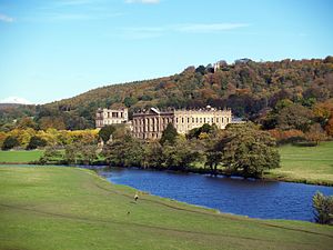
Chatsworth House is a large country house at Chatsworth, Derbyshire, England, 3½ miles north east of Bakewell, originally built by Bess of Hardwick. It is the seat of the Dukes of Devonshire, whose family name is Cavendish. Chatsworth stands on the left bank of the River Derwent and looks across the river to the low hills that divide the valleys of the Derwent and the Wye. The Park is expansive, and the house is backed by rocky hills covered with bracken and heather. The house contains a unique collection of priceless paintings, furniture, Old Master drawings, neoclassical sculpture and other artefacts. Chatsworth's garden is one of the most famous in England. Chatsworth has been selected as the United Kingdom's favourite country house several times.
Selected article 7
Portal:Derbyshire/Selected article/7

Well dressing is a custom practised in rural England in which wells, springs or other water sources are decorated with designs created from flower petals. The custom is most closely associated with the Peak District of Derbyshire in the English Midlands. (see illustration from the 1860s)
The origins of the tradition are said to be in pagan tradition or in giving thanks for the purity of the water drawn from wells during the Black Death. It is said to have originated in Tissington, Derbyshire in 1349, though other claims can be made for Eyam and Stoney Middleton. Whatever its origins it was historically a custom of the Peak District of Derbyshire.
(More on Well Dressing...)
Selected article 8
Portal:Derbyshire/Selected article/8

Swadlincote is a town in the district of South Derbyshire, Derbyshire, England. It is the main town of the district and the site of the South Derbyshire District Council's headquarters. The occupants of Swadlincote often shorten its name to simply 'Swad'.
The population of Swadlincote and its surrounding villages is approximately 33,000. It is made up of separate settlements - Swadlincote, Church Gresley, Midway and Newhall.
The name "Swadlincote" derives from the Anglo-Saxon "Swartlings Cottas", Swartling being an Anglo-Saxon man's name and Cottas meaning cottages. At the time of the Domesday Survey Swadlincote was just a small manor. The area remained rural until industrialisation in the eighteenth century. The presence of coal and clay in the area led to urbanisation as colleries, brickworks and potteries came to dominate Swadlincote.
Selected article 9
Portal:Derbyshire/Selected article/9

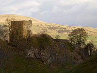
Peveril Castle (also Castleton Castle or Peak Castle)[1] is a medieval building overlooking the village of Castleton. Its site provides views across the Hope Valley and Cave Dale. The castle is named after its founder, William Peveril, who held lands in Derbyshire on behalf of William I. It was built sometime between the Norman Conquest and its first recorded mention in the Domesday Survey. Nearby Castleton benefited from the presence of the castle, which acted as the administrative centre of an independent lordship called Peak.
The site today is cared for by English Heritage and situated in a national park. Peveril Castle is protected as a Scheduled Monument and a Grade I listed building.
Selected article 10
Portal:Derbyshire/Selected article/10

Buxton is a spa town in Derbyshire, England. Located close to the county boundary with Cheshire to the west and Staffordshire to the south, Buxton is described as "the gateway to the Peak District National Park". A municipal borough until 1974, Buxton was then merged with other localities including Glossop, lying primarily to the north, to form the local government district and borough of High Peak within the county of Derbyshire. The Old Hall Hotel was where Mary, Queen of Scots was held when she was allowed to take the waters.
Selected article 11
Portal:Derbyshire/Selected article/11

Tom Hulatt, (7 September 1930 – 21 May 1990) was an English athlete notable for finishing third behind Sir Christopher Chataway in the historic race in which Sir Roger Bannister ran the first sub-four-minute mile on 6 May 1954. He was from a working class family and the only runner in the race who was not a university student. Hulatt was born in Tibshelf, Derbyshire and he worked as a miner at Williamthorpe Colliery. Hould run 5 miles there and back each day. He also worked as a rat catcher and in his spare time he ran for Alfreton Athletics Club, Chesterfield Harriers, Hallamshire Harriers and London Polytechnic.
Selected article 12
Portal:Derbyshire/Selected article/12

Derwent Valley Mills is a World Heritage Site along the River Derwent in Derbyshire, England, designated in December 2001. It is administered by the Derwent Valley Mills Partnership. The modern factory, or 'mill', system was born here in the 18th century to accommodate the new technology for spinning cotton developed by Richard Arkwright. With advancements in technology, it became possible to produce cotton continuously. The system was adopted throughout the valley, and later across the Britain so that by 1788 over 200 Arkwright-type mills in Britain. Arkwright's inventions and system of organising labour was exported to Europe and the United States.
Water-power was first introduced to England by John Lombe at his silk mill in Derby in 1719, but it was Richard Arkwright who applied water-power to the process of producing cotton in the 1770s.
(More on Derwent Valley Mills...)
Selected article 13
Portal:Derbyshire/Selected article/13

The Nutbrook Canal was a canal in England which ran between Shipley, Derbyshire and the Erewash Canal, joining it near Trowell. It was built to serve collieries at Shipley and West Hallam, and was completed in 1796. Most of it was closed in 1895, although some remained in use until 1949.
In 1791, Edward Miller Mundy, the owner of Shipley Hall, and Sir Henry Hunloke of Wingerworth, owner of the West Hallam collieries, investigated the possibility of building a canal without an Act of Parliament. However, an Act was sought in 1792, but it was defeated in March, by objections from landowners who wanted it to be owned by a public company, rather than the mine owners. The canal engineer William Jessop was asked to produce a detailed design for the canal, which he estimated would cost £12,542, and John Nuttall surveyed the route and produced detailed plans. The Act of Parliament authorising construction was obtained on 3 June 1793, and allowed the owners to raise £13,000, with a further £6,500 if required.
Selected article 14
Portal:Derbyshire/Selected article/14

Andrew Handyside and Company was an iron founder in Derby, England in the nineteenth century.
Handyside worked in his uncle Charles Baird's engineering business in Saint Petersburg before taking over the Brittania Foundry in 1848. It had first been opened around 1820 by Weatherhead and Glover to cast ornamental ironwork, and had achieved a high reputation from the skill of the workers and the quality of its moulding sand.
By the 1840s it was diversifying into railway components. Among the early customers were the Midland Railway's Derby Works for which it supplied cylinder blocks and other castings.
Handyside's output ranged from garden ornaments to railway bridges. He produced lamp posts for the new gas street lighting (one of which still exists in the Wardwick in Derby) and was one of the first to produce the new standard Post Office letterboxes. The company also supplied a dome for Henry Bessemer's conservatory.
Selected article 15
Portal:Derbyshire/Selected article/15

Colin Bloomfield (c. 1982 – 25 April 2015) was a radio personality known for his coverage of Derby County F.C. on BBC Radio Derby, as a reporter and commentator. Following his terminal prognosis for melanoma, he became an activist and fundraiser, setting up an eponymous appeal to educate children about the illness. Bloomfield was born in Montford Bridge, Shropshire. His father Lawrie was the first managing editor of BBC Radio Shropshire. Bloomfield spent ten years working at BBC Radio Derby. In 2015, he initiated the Colin Bloomfield Melanoma Appeal in conjunction with BBC Radio Derby, the Derby Telegraph and charity Skcin.
(The picture is of the Derby Rams mascot. Click here for more on Colin Bloomfield...)
Selected article 16
Portal:Derbyshire/Selected article/16

The Allenton Hippo is a substantive hippopotamus (Hippopotamus amphibius) skeleton that was found in Allenton, Derby, England in 1895. The skeleton is exhibited in Derby Museum and Art Gallery and is 3 metres (9.8 ft) in length. It is celebrated today in a sculpture near to where the skeleton was discovered.
The suburb of Derby called Allenton used to be a village 5 kilometres (3 mi) from Derby. Digging of a new well at the Crown Inn was undertaken in March 1895, but work stopped when the diggers discovered a bad smell and then large and unusual bones. Several people agreed to fund further investigations and that the findings should be shared with the community. The hole was extended until it was 4.5 square metres (48 sq ft) in area ...
Selected article 17
Portal:Derbyshire/Selected article/17

Albert Henry Stanley, 1st Baron Ashfield, PC, Kt, TD (8 August 1874 – 4 November 1948), born Albert Henry Knattriess, in New Normanton, Derbyshire, England, the son of Henry and Elizabeth Knattreiss (née Twigg). He was chairman of the Underground Electric Railways Company of London and chairman of the London Passenger Transport Board, during the London Underground's greatest period of expansion. He was also President of the Board of Trade between 1916 and 1919.
Selected article 18
Portal:Derbyshire/Selected article/18

The Duffield Bank Railway was built by Sir Arthur Percival Heywood in the grounds of his house on the hillside overlooking Duffield, Derbyshire in 1874. The Ordnance Survey map for 1880 does not show the railway itself, it does show two tunnels and two signal posts.
Heywood added some stations, as well as a sleeping car with toilet and a diner with its own cooking compartment.
Selected article 19
Portal:Derbyshire/Selected article/19

The Cromford Canal ran 14.5 miles (23 km) from Cromford to the Erewash Canal in Derbyshire, England with a branch to Pinxton. Built by William Jessop with the assistance of Benjamin Outram, its alignment included four tunnels and 14 locks.[2]
From Cromford it ran south following the 300-foot (91 m) contour line along the east side of the valley of the Derwent to Ambergate, where it turned eastwards along the Amber valley. It turned sharply to cross the valley, crossing the river and the Ambergate to Nottingham road, by means of an aqueduct at Bullbridge, before turning towards Ripley. From there the Butterley Tunnel took it through to the Erewash Valley.
Selected article 20
Portal:Derbyshire/Selected article/20

Derby Museum and Art Gallery was established in 1879, along with Derby Central Library, in a new building designed by Richard Knill Freeman and given to Derby by Michael Thomas Bass. The collection includes a whole gallery displaying the paintings of Joseph Wright of Derby; there is also a large display of Royal Crown Derby and other porcelain from Derby and the surrounding area. Further displays include archaeology, natural history, geology and military collections. The Art Gallery has been open since 1882. Derby Museums has agreed a partnership with Wikipedia and there is a backstage pass event on April 9th.
Selected article 21
Portal:Derbyshire/Selected article/21

Treak Cliff Cavern is a show cave near Castleton in Derbyshire, England. It is part of the Castleton Site of Special Scientific Interest and one of only two sites where the ornamental mineral Blue John (vein pictured) is still excavated (the other is the nearby Blue John Cavern). None of the Blue John which can be seen by visitors is now mined. This is part of an agreement with English Nature. However it is still mined from other ares of the cavern but the quantities are not large. The mineral that is mined is converted into saleable items like bowls, jewellery and ornaments.
