Ptsich
Appearance
(Redirected from Ptich)
| Ptsich | |
|---|---|
 | |
 | |
| Location | |
| Country | Belarus |
| Physical characteristics | |
| Source | |
| • location | Pyetrykaw District |
| Mouth | Pripyat River |
• coordinates | 52°08′46″N 28°51′52″E / 52.1460°N 28.8645°E |
| Length | 421 km (262 mi)[1] |
| Basin size | 9,470 km2 (3,660 sq mi)[1] |
| Basin features | |
| Progression | Pripyat→ Dnieper→ Dnieper–Bug estuary→ Black Sea |
 | |
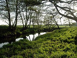
The Ptsich, or Pcič[2] (Belarusian: Пціч, [ptsʲitʂ]) is a river in Eastern Europe.[1] It flows south through Belarus, taking its source near Minsk, and draining into the Pripyat, being its left tributary. It is 421 kilometres (262 mi) long, and has a drainage basin of 9,470 square kilometres (3,660 sq mi).[3][1]
Its biggest tributary is the Aresa.[3]
References
[edit]- ^ a b c d "Main Geographic Characteristics of the Republic of Belarus. Main characteristics of the largest rivers of Belarus". Land of Ancestors. Data of the Ministry of Natural Resources and Environmental Protection of the Republic of Belarus. 2011. Archived from the original on 15 January 2014. Retrieved 27 September 2013.
- ^ official transliteration
- ^ a b Птичь, Great Soviet Encyclopedia
