
Punta del Este Street Circuit
.svg) | |
| Location | Punta del Este, Uruguay |
|---|---|
| Time zone | UTC-03:00 |
| Coordinates | 34°57′17″S 54°56′4″W / 34.95472°S 54.93444°W |
| Major events | Formula E 2014– |
| Length | 2.785 km (1.7 miles) |
| Turns | 20 |
| Race lap record | 1:17.413 (Sébastien Buemi, Renault e.Dams, 2015) |
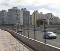
Punta del Este Street Circuit is a street circuit first used on 13 December 2014 during the third ePrix of Formula E. It runs along Punta del Este's harbour – nicknamed the Monte Carlo of South America – and is based on the former TC2000 circuit. The track is 2.8 km in length and features 20 turns.[1][2][3]
Modifications
For season two, the circuit was slightly modified. The first corner was changed, instead of a right-left chicane it is now left-right. The idea behind this change is to make the pit exit much safer than last year, where the cars were exiting the pits on the racing line. This also slightly reduced the lap length to 2.785 km.[4]
Gallery
-
 2010 - TC2000
 -
 2010 - Superturismo
 -
 2010 - Turismo Libre
 -
 2014 - Superturismo
 -
 2014 - Formula E


_-_Superturismo_-_Norte_1.JPG)

References
- ^ "Circuit Guide | Punta del Este, Uruguay | FIA Formula E". FIA Formula E. Retrieved 2014-08-24.
- ^ "Formula E reveals circuit for Punta del Este ePrix". FIA Formula E. 2014-06-20. Retrieved 2014-08-24.
- ^ "Formula E unveils Punta del Este circuit in Uruguay". autosport.com. 2014-06-20. Retrieved 2014-08-24.
- ^ "Punta del Este ePrix - Circuit guide". FIA Formula E. 2015-12-09.
This article about sports in Uruguay is a stub. You can help Wikipedia by expanding it. |
This article about a motor sport venue is a stub. You can help Wikipedia by expanding it. |