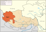
Risum Township
Risong Township
日松乡 | |
|---|---|
| Coordinates: 33°11′37″N 79°49′22″E / 33.19361°N 79.82278°E | |
| Country | People's Republic of China |
| Region | Tibet |
| Prefecture | Ngari |
| County | Rutog |
| Elevation | 4,335 m (14,222 ft) |
| Time zone | UTC+8 (China Standard) |
Risong Township (simplified Chinese: 日松乡; traditional Chinese: 日松鄉; pinyin: Rìsōng Xiāng; Standard Tibetan: ???) is a township of Rutog County, in far western Tibet Autonomous Region, People's Republic of China,[1] located 28 kilometres (17 mi) south of Pangong Tso, a large lake, and 81 km (50 mi) north of the seat of Ngari Prefecture. As of 2011[update], it has 3 villages under its administration.[2] It is directly serviced by China National Highway 219.
References
- ^ 2011年统计用区划代码和城乡划分代码:日土县 (in Chinese). National Bureau of Statistics of the People's Republic of China. Retrieved 2012-07-16.
- ^ 2011年统计用区划代码和城乡划分代码:日松乡 (in Chinese). National Bureau of Statistics of the People's Republic of China. Retrieved 2012-07-16.[permanent dead link]


