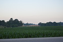
Robinson Township, Posey County, Indiana
Appearance
Robinson Township | |
|---|---|
 State Road 66 southeast of Blairsville | |
 | |
| Coordinates: 38°03′01″N 87°45′03″W / 38.05028°N 87.75083°W | |
| Country | United States |
| State | Indiana |
| County | Posey |
| Government | |
| • Type | Indiana township |
| Area | |
| • Total | 39.14 sq mi (101.37 km2) |
| • Land | 39.13 sq mi (101.34 km2) |
| • Water | 0.01 sq mi (0.04 km2) |
| Elevation | 459 ft (140 m) |
| Population (2000) | |
| • Total | 3,976 |
| • Density | 101.62/sq mi (39.24/km2) |
| FIPS code | 18-65124[2] |
| GNIS feature ID | 453806 |
Robinson Township is one of ten townships in Posey County, Indiana. As of the 2000 census, its population was 3,976.
Robinson Township was named at an unknown date for Jonathan Robinson, an early settler.[3]
Unincorporated Places
References
- ^ "US Board on Geographic Names". United States Geological Survey. 2007-10-25. Retrieved 2008-01-31.
- ^ "American FactFinder". United States Census Bureau. Retrieved 2008-01-31.
- ^ Leffel, John C. (1913). History of Posey County, Indiana. Standard Publishing Company. p. 82.
External links

