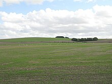
Roundway Down and Covert

Roundway Down and Covert (grid reference SU000646) is an 86 hectare biological Site of Special Scientific Interest near Devizes in Wiltshire, England. It was notified in 1971.
Roundway Down was the site of a battle in 1643 during the First English Civil War.
Sources
- English Nature citation sheet for the site (accessed 14 August 2006)
External links
- English Nature website (SSSI information)
51°22′50″N 2°00′05″W / 51.38045°N 2.00139°W
