Rudder Cut Cay Airport
Appearance
Rudder Cut Cay Airport | |||||||||||
|---|---|---|---|---|---|---|---|---|---|---|---|
| Summary | |||||||||||
| Airport type | Public | ||||||||||
| Serves | Rudder Cut Cay | ||||||||||
| Location | Bahamas | ||||||||||
| Elevation AMSL | 10 ft / 3 m | ||||||||||
| Coordinates | 23°53′11.1″N 76°15′10.2″W / 23.886417°N 76.252833°W | ||||||||||
| Map | |||||||||||
 | |||||||||||
| Runways | |||||||||||
| |||||||||||
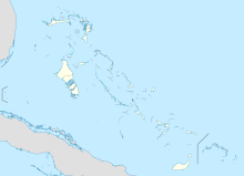
Rudder Cut Cay Airport is a public use airport located near Rudder Cut Cay, the Bahamas.
See also
References
- ^ Airport record for Rudder Cut Cay Airport at Landings.com. Retrieved 2013-08-08
- ^ "location of Rudder Cut Cay Airport" (Map). Google Maps. Retrieved 2013-08-08.
External links
- Airport record for Rudder Cut Cay Airport at Landings.com

