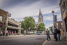
Wellington Street (Montreal)
This article needs additional citations for verification. (November 2024) |
 | |
| Native name | rue Wellington (French) |
|---|---|
| Part of | |
| Owner | City of Montreal |
| Length | 5.7 km (3.5 mi) |
| Location | Montreal |
| Coordinates | 45°28′34″N 73°33′37″W / 45.4760°N 73.5602°W |
| West end | Boulevard LaSalle, Verdun |
| East end | Rue McGill, Old Montreal |
Wellington Street (officially in French: Rue Wellington) is a north–south thoroughfare located in Montreal, Quebec, Canada. It starts at LaSalle Boulevard in the borough of Verdun, passes through Pointe-Saint-Charles and Griffintown in the borough of Le Sud-Ouest, and terminates at McGill Street in Old Montreal in the borough of Ville-Marie. Wellington Street spans 5.7 km (3.5 mi) in length.
De L'Église métro station is located on the street.
Wellington Street is named for Arthur Wellesley, 1st Duke of Wellington (1769–1852), a British field marshal and two-time prime minister of the United Kingdom. The Duke of Wellington is best known for having defeated Napoleon I of France in the Battle of Waterloo in June 1815.[1]
Wellington Street serves as a shopping district for the borough of Verdun and most of the neighbourhood of Pointe Saint-Charles. It is primarily industrial between the railroad tracks in Pointe Saint-Charles and the Bonaventure Expressway. The electrical substation Poste Adélard-Godbout and the de L'Église metro station are sited on the street.
Points of interest
[edit]- Square des Frères-Charon
- Marguerite Bourgeoys Park
- St. Ann Park
References
[edit]- ^ "WELLINGTON, rue (avant 1844)" (in French). Rues de Montréal. Retrieved 27 February 2010.
