San Juan River (Colombia)
| Río San Juan | |
|---|---|
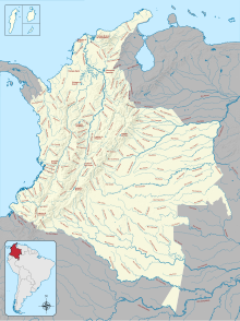
 Rivers in Colombia. The mouth of the San Juan is near the center of the country's Pacific coast | |
| Location | |
| Country | Colombia |
| Region | Chocó Department |
| Physical characteristics | |
| Source | |
| • location | Cerro Caramanta, West Andes |
| Mouth | |
• location | Pacific Ocean near Buenaventura |
| Length | 380 km (240 mi) |
The San Juan River (Spanish: Río San Juan) is an important river of Colombia that flows into the Pacific Ocean through the Chocó Department. It is approximately 380 kilometres (240 mi) and drains a watershed of 2,100 square kilometres (810 sq mi). The river drains into a large delta that covers nearly 300 square kilometres (120 sq mi).
Geography
The river begins on Cerro Caramanta in the West Andes. The delta is due north of Bahía Málaga and Buenaventura.
The mouth of the river has extensive stands of mangroves, part of the Esmeraldes-Pacific Colombia mangroves ecoregion.[1]
Hydrometry
Monthly average flow of San Juan River ( m³/second) measured at Penitas station
Data from 25 years[2]

See also
References
- ^ Carlos Borda, Northern South America: Northern Colombia, WWF: World Wide Fund for Nature, retrieved 2017-06-19
- ^ Unesco - San Juan River at Penitas Archived 2016-03-03 at the Wayback Machine
External links
- Template:En icon San Juan River delta on coastal.er.usgs.gov
