
Skeeterville, Texas
Skeeterville, Texas | |
|---|---|
 Skeeterville  Skeeterville | |
| Coordinates: 31°21′15″N 98°57′46″W / 31.35417°N 98.96278°W | |
| Country | United States |
| State | Texas |
| County | San Saba |
| Elevation | 1,348 ft (411 m) |
| Time zone | UTC-6 (Central (CST)) |
| • Summer (DST) | UTC-5 (CDT) |
| Area code | 325 |
| GNIS feature ID | 1380551[1] |
Skeeterville is an unincorporated community in San Saba County, in the U.S. state of Texas.[1] According to the Handbook of Texas, the community had a population of 10 in 2000.
History[edit]
The Nowlin Family donated land for a Church of Christ to be built on, and in 1915, erected a brush arbor. Roy “Dogie” Wilson named the community Skeeterville in 1920 because his horse was attacked by mosquitos whenever they would cross the marshy ground. He established a store and gas station in 1927. R.C. Phillips moved his store here from Holt in 1922. A church was built shortly after World War II. A church and a business were located in Skeeterville in 1984 and the community had 10 residents as of 2000.[2]
Geography[edit]
Skeeterville is located on Old Bowser Road on the banks of Wilbarger Creek, 6 mi (9.7 km) north of Richland Springs in northwestern San Saba County.[2]
Education[edit]
Skeeterville did not have a school, so children went to school in either Richland Springs or Locker.[2] Today, the community is served by the Richland Springs Independent School District.
References[edit]
- ^ a b U.S. Geological Survey Geographic Names Information System: Skeeterville, Texas
- ^ a b c Yancy, Karen. "Skeeterville, TX". tshaonline.org. Retrieved February 17, 2023.
Municipalities and communities of San Saba County, Texas, United States | ||
|---|---|---|
| Towns | 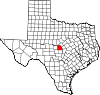 | |
| Unincorporated communities | ||
| Footnotes | ‡This populated place also has portions in an adjacent county or counties | |