
Snow Shoe, Pennsylvania
Snow Shoe, Pennsylvania | |
|---|---|
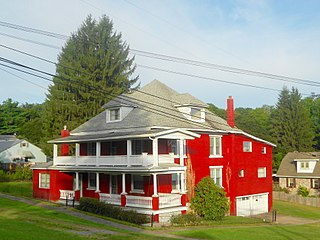
 Former Presbyterian church | |
 Map showing Snow Shoe in Centre County | |
 Map showing Centre County in Pennsylvania | |
| Country | United States |
| State | Pennsylvania |
| County | Centre |
| Settled | 1850 |
| Incorporated (borough) | 1907 |
| Area | |
• Total | 0.6 sq mi (1.5 km2) |
| Elevation | 1,601 ft (488 m) |
| Population (2010) | |
• Total | 765 |
| • Density | 1,286.9/sq mi (496.9/km2) |
| Time zone | Eastern (EST) |
| • Summer (DST) | EDT |
| Zip code | 16874 |
| Area code | 814 |
Snow Shoe is a borough in Centre County, Pennsylvania, United States. It is part of the State College, Pennsylvania Metropolitan Statistical Area. The population was 765 at the 2010 census.
Geography
Snow Shoe is located at 41°1′40″N 77°56′57″W / 41.02778°N 77.94917°W (41.027821, -77.949099).[1]
According to the United States Census Bureau, the borough has a total area of 0.6 square miles (1.6 km2), all of it land.
Demographics
| Census | Pop. | Note | %± |
|---|---|---|---|
| 1880 | 400 | — | |
| 1910 | 643 | — | |
| 1920 | 650 | 1.1% | |
| 1930 | 520 | −20.0% | |
| 1940 | 578 | 11.2% | |
| 1950 | 670 | 15.9% | |
| 1960 | 714 | 6.6% | |
| 1970 | 874 | 22.4% | |
| 1980 | 852 | −2.5% | |
| 1990 | 800 | −6.1% | |
| 2000 | 771 | −3.6% | |
| 2010 | 765 | −0.8% | |
| 2015 (est.) | 776 | [2] | 1.4% |
| Sources:[3][4][5] | |||
As of the census[4] of 2010, there were 765 people, 290 households, and 216 families residing in the borough. The population density was 1,286.9 people per square mile (496.9/km²). There were 333 housing units at an average density of 560.2 per square mile (216.3/km²). The racial makeup of the borough was 99.6% White, 0.1% Asian, and 0.3% of two or more races. Hispanic or Latino of any race were 0.1% of the population.
There were 290 households, out of which 35.5% had children under the age of 18 living with them, 60.0% were married couples living together, 4.1% had a male householder with no wife present, 10.4% had a female householder with no husband present, and 25.5% were non-families. 22.1% of all households were made up of individuals, and 11.8% had someone living alone who was 65 years of age or older. The average household size was 2.64 and the average family size was 3.05.
In the borough the population was spread out, with 24.6% under the age of 18, 8.4% from 18 to 24, 23.9% from 25 to 44, 27.8% from 45 to 64, and 15.3% who were 65 years of age or older. The median age was 40 years. For every 100 females there were 98.2 males. For every 100 females age 18 and over, there were 101.0 males.
The median income for a household in the borough was $48,789, and the median income for a family was $52,847. The per capita income for the borough was $21,225. About 2.1% of families and 2.6% of the population were below the poverty line, including 7.0% of those age 65 or over.
-
 United Methodist Church
 -

-


References
- ^ "US Gazetteer files: 2010, 2000, and 1990". United States Census Bureau. 2011-02-12. Retrieved 2011-04-23.
- ^ "Annual Estimates of the Resident Population for Incorporated Places: April 1, 2010 to July 1, 2015". Retrieved July 2, 2016.
- ^ "Census of Population and Housing". U.S. Census Bureau. Retrieved 11 December 2013.
- ^ a b "American FactFinder". United States Census Bureau. Retrieved 2008-01-31.
- ^ "Incorporated Places and Minor Civil Divisions Datasets: Subcounty Resident Population Estimates: April 1, 2010 to July 1, 2012". Population Estimates. U.S. Census Bureau. Retrieved 11 December 2013.
