
Spaulding, Oklahoma
Spaulding, Oklahoma | |
|---|---|
 Location of Spaulding, Oklahoma | |
| Coordinates: 35°0′49″N 96°26′41″W / 35.01361°N 96.44472°W | |
| Country | United States |
| State | Oklahoma |
| County | Hughes |
| Area | |
| • Total | 3.2 sq mi (8.3 km2) |
| • Land | 3.2 sq mi (8.3 km2) |
| • Water | 0.0 sq mi (0.0 km2) |
| Elevation | 814 ft (248 m) |
| Population (2010) | |
| • Total | 178 |
| • Density | 56/sq mi (21.5/km2) |
| Time zone | UTC-6 (Central (CST)) |
| • Summer (DST) | UTC-5 (CDT) |
| FIPS code | 40-69000[1] |
| GNIS feature ID | 1098340[2] |
Spaulding is a town in Hughes County, Oklahoma, United States. The population was 178 at the 2010 census,[3] up from 62 at the 2000 census, when the town's area was about one-third of its 2010 area.
Geography
Spaulding is located in western Hughes County at 35°0′49″N 96°26′41″W / 35.01361°N 96.44472°W (35.013476, -96.444737).[4] It is 6.5 miles (10.5 km) southwest of Holdenville, the county seat.
According to the United States Census Bureau, the town has a total area of 3.2 square miles (8.3 km2), all of it land.[3] The town drains east to the Little River, a tributary of the Canadian River.
Demographics
| Census | Pop. | Note | %± |
|---|---|---|---|
| 2000 | 137 | — | |
| 2010 | 178 | 29.9% | |
| 2015 (est.) | 173 | [5] | −2.8% |
| U.S. Decennial Census[6] | |||
As of the census[1] of 2000, there were 62 people, 24 households, and 18 families residing in the town. The population density was 61.8 people per square mile (23.9/km²). There were 30 housing units at an average density of 29.9 per square mile (11.6/km²). The racial makeup of the town was 82.26% White, 9.68% Native American, and 8.06% from two or more races.
There were 24 households out of which 25.0% had children under the age of 18 living with them, 62.5% were married couples living together, 12.5% had a female householder with no husband present, and 25.0% were non-families. 25.0% of all households were made up of individuals and 20.8% had someone living alone who was 65 years of age or older. The average household size was 2.58 and the average family size was 3.11.
In the town, the population was spread out with 27.4% under the age of 18, 3.2% from 18 to 24, 24.2% from 25 to 44, 25.8% from 45 to 64, and 19.4% who were 65 years of age or older. The median age was 38 years. For every 100 females, there were 82.4 males. For every 100 females age 18 and over, there were 80.0 males.
The median income for a household in the town was $22,188, and the median income for a family was $23,125. Males had a median income of $21,250 versus $11,250 for females. The per capita income for the town was $13,900. There were 11.8% of families and 25.5% of the population living below the poverty line, including 60.0% of under eighteens and 13.3% of those over 64.
References
- ^ a b "American FactFinder". United States Census Bureau. Retrieved 2008-01-31.
- ^ "US Board on Geographic Names". United States Geological Survey. 2007-10-25. Retrieved 2008-01-31.
- ^ a b "Geographic Identifiers: 2010 Census Summary File 1 (G001): Spaulding town, Oklahoma". American Factfinder. U.S. Census Bureau. Retrieved January 17, 2018.
- ^ "US Gazetteer files: 2010, 2000, and 1990". United States Census Bureau. 2011-02-12. Retrieved 2011-04-23.
- ^ "Annual Estimates of the Resident Population for Incorporated Places: April 1, 2010 to July 1, 2015". Archived from the original on July 14, 2016. Retrieved July 2, 2016.
{{cite web}}: Unknown parameter|deadurl=ignored (|url-status=suggested) (help) - ^ "Census of Population and Housing". Census.gov. Retrieved June 4, 2015.
Municipalities and communities of Hughes County, Oklahoma, United States | ||
|---|---|---|
| Cities | 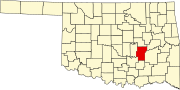 | |
| Towns | ||
| Indian reservations | ||
| Footnotes | ‡This populated place also has portions in an adjacent county or counties | |