
Stříbřec
Stříbřec | |
|---|---|
Municipality | |
.jpg) | |
 Stříbřec | |
| Coordinates: 49°1′29″N 14°52′34″E / 49.02472°N 14.87611°E | |
| Country | |
| Region | South Bohemian |
| District | Jindřichův Hradec |
| Area | |
| • Total | 18.96 km2 (7.32 sq mi) |
| Elevation | 442 m (1,450 ft) |
| Population (2006) | |
| • Total | 455 |
| • Density | 24/km2 (62/sq mi) |
| Postal code | 378 18 |
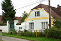
Stříbřec is a village and municipality (obec) in Jindřichův Hradec District in the South Bohemian Region of the Czech Republic.
The municipality covers an area of 18.96 square kilometres (7.32 sq mi), and has a population of 455 (as at 28 August 2006).
Stříbřec lies approximately 17 kilometres (11 mi) south-west of Jindřichův Hradec, 30 km (19 mi) east of České Budějovice, and 123 km (76 mi) south of Prague.
Gallery
-
 Church
 -
 Local part Mníšek
 -
 Local part Libořezy
.jpg)


References
Wikimedia Commons has media related to Stříbřec.
This South Bohemian Region location article is a stub. You can help Wikipedia by expanding it. |