Susten Pass
Appearance
| Susten Pass | |
|---|---|
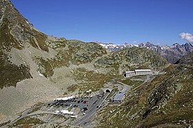
 View of the Bernese side of the pass with the tunnel | |
| Elevation | 2,260 m (7,415 ft)[1] |
| Traversed by | Road (2,224 m) |
| Location | Bern/Uri, Switzerland |
| Range | Urner Alps |
| Coordinates | 46°43.8′N 08°26.94′E / 46.7300°N 8.44900°E |
Susten Pass (German: Sustenpass) (el. 2260 m.) is a mountain pass in the Swiss Alps. The pass road, built from 1938–1945, connects Innertkirchen in the canton of Bern with Wassen in the canton of Uri. A 300 metres long tunnel crosses the pass at 2,224 metres.
The pass is popular with tourists, especially for the views of the Stein Glacier on the south side.
See also
References
External links
Wikimedia Commons has media related to Sustenpass.
- Profile on climbbybike.com (from Wassen)
- Profile on climbbybike.com (from Innertkirchen)
- Pictures from Sustenpass, summer 2011

