Bastion Point
Takaparawhau / Bastion Point
Takaparawhau (Māori) | |
|---|---|
Headland | |
 Takaparawhau / Bastion Point seen from the fishing pier jutting out into the Waitematā Harbour. | |
| Coordinates: 36°50′39″S 174°49′27″E / 36.84417°S 174.82417°E | |
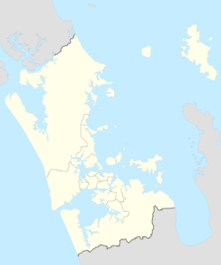
| Location | Auckland, New Zealand |
| Part of | Ōrākei |
| Offshore water bodies | Waitematā Harbour |
| Native name | Takaparawhau (Māori) |

Takaparawhau / Bastion Point is a coastal piece of land in Ōrākei, Auckland, New Zealand, overlooking the Waitematā Harbour. The area is significant in New Zealand history as the site of protests in the late 1970s by Māori against forced land alienation by Pākehā (European settlers).[1] Takaparawhau is now the site of the private Ōrākei Marae, the public Michael Joseph Savage Memorial, and privately-owned reserve land that is accessible to the public.
Naming
[edit]Māori originally named the eastern point of the area Kohimarama, meaning to collect the remnants / wood chips, and the western point was named Takaparawhau. Felton Mathew changed the name of Kohimarama to South Head. Just off that point was Bastion Rock, which was levelled and is now the site of the Tamaki Yacht Club.[2] Bastion Point became the common Pākehā name for the site encompassing both points. The nearby beach named Waiparera by Māori was changed to Kohimarama Beach by Pākehā. Ngāti Whātua Ōrākei, who own most of the land again, call it Takaparawhau, which, along with Ōkahu Bay, form Whenua Rangatira, which is vested in Ngāti Whātua Ōrākei for the common use and benefit of Ngāti Whātua Ōrākei and citizens of Auckland, and is managed by the Ngāti Whātua Ōrākei Reserves Board.[3][4][5][6] The public land containing the Michael Joseph Savage Memorial and Fort Britomart tunnels is not owned by the hapū, who refer to it as Kohimarama, while Auckland Council now call it Takaparawhau.[7]
History
[edit]
The land was occupied by Ngāti Whātua Ōrākei, and before the colonisation of New Zealand it was part of important lands for the hapū, overlooking rich fishing and farming areas.[8] The surrounding land was purchased and confiscated by the New Zealand Government for public works and development over a period stretching from the 1840s into the 1950s.[5]
On 20 March 1840, in the Manukau Harbour area where Ngāti Whātua farmed, paramount chief Apihai Te Kawau signed Te Tiriti o Waitangi. Ngāti Whātua sought British protection from Ngāpuhi as well as a reciprocal relationship with the Crown and the Church. Soon after signing Te Tiriti, Ngāti Whātua Ōrākei, the primary hapū and landowner in Tāmaki Makaurau, made a tuku (strategic gift) of 3,500 acres (1,400 hectares) of land on the Waitematā Harbour to William Hobson, the new Governor of New Zealand, for the new capital. By 1859, Ngāti Whātua Ōrākei, who had given two further land tuku of 13,200 acres (5,342 hectares) to the Crown, had lost most of their remaining land through speculators. The 700-acre Ōrākei block was all that remained. Within a century, this too was compulsorily acquired by the Crown (apart from a cemetery).[9][10][11][12][13][5]
Apihai Te Kawau spoke publicly against land sales and in order to safeguard a small amount of land in Ōrākei for future generations, and Te Kawau obtained a Crown Grant in 1869. In 1873, the Native Land Court stated that "the land shall be inalienable". A reversal of this government position came with the Validation Of Invalid Land Sales Act 1894. In 1885, the New Zealand Government built a military outpost at Bastion Point, because of its commanding strategic position overlooking the Waitematā Harbour, known as Fort Bastion. The outpost was not built on Takaparawha Point, which had earlier been taken by the Government for the same purpose.[14] In 1886, the Crown used the Public Works Act 1882 (46 Vict No 37) to take ownership of 13 acres (5.3 ha) of Bastion Point for this purpose of defence. From 1913 and 1928, the government bought most of the land that had been previously deemed inalienable. As Ranganui Walker states, this is by no means a simple case of willful dispossession: "In a long running battle to resist the state and save the land, there were eight actions in the Maori Land Court, four in the Supreme Court, two in the Court of Appeal, two in the Compensation Court, six appearances before Commissions or Committees of Inquiry, and fifteen Parliamentary Petitions. In the end the state prevailed".[15][16]
In 1936, Ōrākei was proposed as a site for state housing by the First Labour Government, and in August a Māori delegation asked Prime Minister Savage that at least the marae on the flat foreshore where he had been ceremonially welcomed after his election should be retained by the tribe. Savage was 'somewhat fogged' by the situation and asked for reports, which were not completed when he sailed to Britain for the Coronation and Imperial Conference in 1937. The Labour state housing team John A. Lee and Frank Langstone decided that the 120 Māori living at Ōrākei were illegal squatters and had to be removed. The incensed Ōrākei Māori met Savage on his return from overseas, and he immediately reversed the decision, avoiding what could have been a political crisis.[17] In November 1936, Lee had assured Walter Nash that the Māori would be removed without much difficulty; but they refused, and were supported by the Clergy Association, the Protestant churches, the Anglican Bishop, the Friends of Orakei and the New Zealand Observer. Robin Hyde wrote No More Dancing at Orakei. Lee obtained most of his land, but Langstone's (and the Cabinet's) decision; seen as obtaining Māori land as a park 'for white children' was reversed. Another motive for their proposal was to weaken Bill Endean's grip on Parnell, the only non-Labour seat in Auckland.[18] Māori from the pā met Savages' body when it arrived back in Auckland in 1940.[19]
In 1941, the Crown no longer needed Bastion Point for defence, it did not return the land to its traditional Māori owners but instead gifted it to the Auckland City Council for a reserve. (This was the last 60 acres (24.3 ha) of uncommitted land at Ōrākei that Ngāti Whātua Ōrākei still hoped to get back.)[5]
During World War II, three searchlights were housed in emplacements built at the foot of Bastion Point, and still exist today. Guns, searchlights, and an anti-submarine boom stretched to Torpedo Bay near North Head, were installed at the front of the Tamaki Yacht Club, and were later incorporated into the yacht club building.[2]
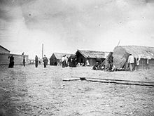
In 1951, Māori living in Ōrākei were evicted and the houses were knocked down. A justification for this eviction was health and sanitation issues, for which the government was ultimately responsible. These issues were created by the city council earlier when a sewer line and road were built along the foreshore which blocked the flow of storm water, creating the quagmire of sanitation problems. At the same time the village at Ōkahu Bay was not connected to the city's fresh water supply.[20][5]
Savage Memorial
[edit]
The first Labour Prime Minister of New Zealand, Michael Joseph Savage died in office in 1940, and is buried in an Art Deco mausoleum at Takaparawhau / Bastion Point designed by Tibor Donner and Anthony Bartlett with a sculpture by R. O. Gross, built above the disused Fort Britomart. It has large columns, sunken gardens and a reflecting pool which was built in two years by Fletcher Construction for £34,533, with the cost raised by subscription.[21][7]
The monument was dedicated before a crowd of ten thousand on 28 March 1943, with Savage's remains reinterred in a deep tunnel below the monument. The tomb is inscribed: Michael Joseph Savage, 1872–1940, He loved his fellow men.[21]
Occupation and return
[edit]

In 1976, the Crown announced that it planned to develop Bastion Point by selling it to the highest bidder for high-income housing. Joe Hawke, members of his hapū Ngāti Whātua Ōrākei, and other activists, formed the Orakei Māori Action Committee, taking direct action to stop the subdivision. The government claimed that the land had been sold to the Crown, however Hawke claimed that, "This land was not sold – it was confiscated under the Public Works Lands Act".[23]
From 1977 to 1978, the Orakei Māori Action Committee organised and maintained an occupation of the remaining Crown land. The occupation began on 5 January 1977,[24] two days before construction of the housing was to start, to prevent its confiscation by the Muldoon Government.[14] The occupiers constructed a marae and housing, and grew crops. A fire in a tent on 26 September 1977 caused the death of a young girl named Joanna Hawke, the niece of protest leader Joe Hawke.[25]
The occupation lasted for 506 days; it ended on 25 May 1978,[1][26] when 800 police and personnel of the New Zealand Army forcibly removed the occupiers and destroyed the temporary buildings—including vegetable gardens and the marae. Two hundred and twenty two protesters were arrested. The occupation and the use of force to end it played a part in highlighting injustices against Māori, and the occupation became a major landmark in the history of Māori protest.[26]
In 1988, the New Zealand Labour Government returned Takaparawhau / Bastion Point and Ōrākei Marae to Ngāti Whātua Ōrākei, with compensation, as part of a Treaty of Waitangi settlement process. The 1991 Ōrākei Act was passed to recognise the rights of Ngāti Whātua Ōrākei under the treaty.[27][28]
Joe Hawke died on 22 May 2022, aged 82 and was buried at Takaparawhau, the land he fought to return to his iwi.[29][30]
See also
[edit]Gallery
[edit]-
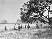
Looking east along Biddicks Bay towards Takaparawha showing Bastion Rock, since demolished, 1901.
-
Looking east to Takaparawhau showing Tamaki Yacht Club where Bastion Rock was removed, 2022.
-
Looking north east along Ōkahu Bay towards Takaparawhau, showing the sewer line in course of construction, 1910.
-
Looking north east along Ōkahu Bay towards Takaparawhau, with Tumutumuwhenua wharenui (meeting house) visible on the ridgeline, 2022.
-
Takaparawha Pou (pole or column) installed at Takaparawhau (Bastion Point) in 2019, designed by Lenard Philips and Te Aroha Witika. The pou has the shape of a taurapa (the stern of a waka) standing on a concrete plinth representing the toka (rock) that acted as a beacon for waka, known as Bastion Rock.[31]
-
Takaparawhau searchlight emplacements, numbers one and two, completed in 1944.
-
Panorama showing the annual Manu Aute Kite Day, held on Takaparawhau on the first Matariki long weekend, June 2022.
-
Panorama showing Tamaki Yacht Club, both Takaparawhau points and searchlight emplacement number three, 2022
References
[edit]- ^ a b Police cordon At Bastion Point (3rd of 3) (from Te Ara: The Encyclopedia of New Zealand. Accessed 31 July 2008.)
- ^ a b The Bastion and the Searchlight Emplacements, info panel. Ōrākei Local Board, Auckland Council. June 2022
- ^ Jackson, Elizabeth T. (1976). Delving Into The Past of Auckland's Eastern Suburbs: Section 4 Mission Bay, Section 5 Kohimarama.
- ^ Ngāti Whātua Ōrākei Reserves Board. "Combined Reserve Management Plan". Retrieved 21 June 2022.
- ^ a b c d e "The loss of the Orakei block | Waitangi Tribunal". waitangitribunal.govt.nz. Retrieved 3 August 2021.
- ^ Council, Auckland. "Ngāti Whātua Ōrākei Reserves Board". Auckland Council. Retrieved 20 June 2022.
- ^ a b "First look at Bastion Point's excavated tunnels". RNZ. 30 April 2018. Retrieved 21 June 2022.
- ^ "Orakei | Waitangi Tribunal". waitangitribunal.govt.nz. Retrieved 3 August 2021.
- ^ "Apihai Te Kawau". Ngāti Whātua-o-Ōrākei. Archived from the original on 11 August 2019. Retrieved 11 August 2019.
- ^ "Cultural Values Assessment in Support of the Notices of Requirement for the Proposed City Rail Link Project" (PDF). Auckland Transport. pp. 14–16. Archived (PDF) from the original on 11 December 2019. Retrieved 3 May 2021.
- ^ "Tāmaki Herenga Waka: Stories of Auckland". Flickr. Auckland Museum. 18 April 2021. Retrieved 3 May 2021.
- ^ Ngāti Whātua Ōrākei Trust (2 June 2021). "Statement of evidence of Ngarimu Alan Huiroa Blair on behalf of the plaintiff" (PDF). ngatiwhatuaorakei.com. Archived (PDF) from the original on 2 August 2021. Retrieved 2 August 2021.
- ^ "Ngāti Whātua Ōrākei Deed of Settlement" (PDF). govt.nz. 5 November 2011. Archived (PDF) from the original on 12 February 2020. Retrieved 2 August 2021.
- ^ a b "'Reclaiming Bastion Point – roadside stories'". www.nzhistory.net.nz. Retrieved 8 November 2016.
- ^ Walker, Ranganui (1990). Ka Whawhai Tonu Matou Struggle Without End. Penguin. pp. 216–217. ISBN 0143019457.
- ^ Taonui, Rāwiri. "Ngāti Whātua - Ngāti Whātua and the Treaty of Waitangi". Te Ara - the Encyclopedia of New Zealand. Retrieved 3 August 2021.
- ^ Gustafson 1986, p. 191.
- ^ Olssen 1977, pp. 105, 106.
- ^ Gustafson 1986, p. 271.
- ^ Walker, Ranganui (1990). Ka Whawhai Tonu Matou Struggle Without End. Penguin. p. 217. ISBN 0143019457.
- ^ a b Gustafson 1986, p. 272.
- ^ "Solemn dawn ceremony to remember the end of the Bastion Point occupation in Auckland". The New Zealand Herald. 25 May 2018. Retrieved 12 December 2023.
- ^ "The 1977 Bastion Point occupation: What happened?". 1 News. Retrieved 26 January 2024.
- ^ "Maoris in New Zealand regain Bastion Point by occupying their land, 1977–1978", Global Nonviolent Action Database, Swarthmore College
- ^ "Report of the Waitangi Tribunal on the Orakei Claim – 9.4 The Assessment of Competing Claims". Waitangi Tribunal. Archived from the original on 17 October 2008.
- ^ a b "Dawn service marks 40 years since eviction at Bastion Point". Stuff. 24 May 2018. Retrieved 4 June 2018.
- ^ "Resolving the grievances of the past | Waitangi Tribunal". waitangitribunal.govt.nz. Retrieved 3 August 2021.
- ^ Ngāti Whātua Ōrākei & St Paul's Church. "Ngāti Whātua Ōrākei Timeline". St Paul's Church. Retrieved 4 August 2021.
- ^ Anderson, Ryan; Earley, Melanie (22 May 2022). "Ngāti Whātua Bastion Point protest leader Joe Hawke dies, aged 82". Stuff. Retrieved 22 May 2022.
- ^ "Joe Hawke now rests at Takaparawhau". Māori Television. Retrieved 21 June 2022.
- ^ NZ Outdoor Art. "Pou". Facebook. Retrieved 1 August 2022.
Sources
[edit]- Gustafson, Barry (1986). From the Cradle to the Grave: a biography of Michael Joseph Savage. Auckland: Reed Methuen. ISBN 0-474-00138-5.
- Olssen, Erik (1977). John A. Lee. Dunedin: University of Otago Press. pp. 105, 106. ISBN 0-908569-04-1.
External links
[edit]- Television footage of Bastion Point eviction, from Te Ara: The Encyclopedia of New Zealand, the Encyclopedia of New Zealand
- Report on the Orakei claim, Waitangi Tribunal
- Radio NZ sound bite interviews on the 1970s Bastion Point protest.
- "Bastion Point – The Untold Story", clip from documentary


![Takaparawha Pou (pole or column) installed at Takaparawhau (Bastion Point) in 2019, designed by Lenard Philips and Te Aroha Witika. The pou has the shape of a taurapa (the stern of a waka) standing on a concrete plinth representing the toka (rock) that acted as a beacon for waka, known as Bastion Rock.[31]](http://upload.wikimedia.org/wikipedia/commons/thumb/6/66/Takaparawhau_Pou.JPG/180px-Takaparawhau_Pou.JPG)
