Tazmalt
Appearance
Tazmalt
تازمالت ⵜⴰⵣⵎⴰⵍⵜ | |
|---|---|
town | |
 | |
| Nickname: Tazeradjt | |
| Country | Algeria |
| Province | Béjaïa |
| Area | |
• Total | 33.64 km2 (12.99 sq mi) |
| Population (2008) | |
• Total | 28,891 |
| • Density | 860/km2 (2,200/sq mi) |
| Time zone | UTC+1 (West Africa Time) |
| Postal codes | 06006 |
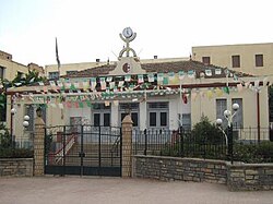
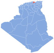
Tazmalt is a town in northern Algeria. It's about 85 km south west of Bejaia, 50 km at east of Bouira, 55 km south east of Tizi Ouzou, and 165 km south east of the capital Algiers. Tazmalt is the biggest city of Sahel-Djurdjura region, and the fourth in its own region which is called Kabylia (Kabylie in French), with a population of 25,000.


