Tnuvot
Tnuvot
| |
|---|---|
 | |
| Coordinates: 32°18′19.8″N 34°57′45.71″E / 32.305500°N 34.9626972°E | |
| Country | Israel |
| District | Central |
| Council | Lev HaSharon |
| Affiliation | Moshavim Movement |
| Founded | 1952 |
| Founded by | Yemenite immigrants |
| Population (2022)[1] | 863 |
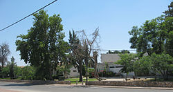
Tnuvot (Template:Lang-he-n, lit. Crops) is a moshav in central Israel. Located in the Sharon plain between Netanya and Tulkarm, it falls under the jurisdiction of Lev HaSharon Regional Council. In 2022 it had a population of 863.[1]
History
The village was founded in 1952 by Jewish immigrants from Yemen. Its name is symbolic for its agricultural base and was taken from the Bible by the verse : "He made him ride on the high places of the earth, and he did eat the fruitage of the field; and He made him to suck honey out of the crag, and oil out of the flinty rock" (Deuteronomy 32,13).
A historical ancient site with a mosaic from the Roman-Byzantine era, called "Tel Shevah" is located nearby, as is a landing strip for ultralight aviation.
References
- ^ a b "Regional Statistics". Israel Central Bureau of Statistics. Retrieved 21 March 2024.

