Uiseong County
You can help expand this article with text translated from the corresponding article in Korean. (July 2012) Click [show] for important translation instructions.
|
Uiseong
의성군 | |
|---|---|
| Korean transcription(s) | |
| • Hangul | 의성군 |
| • Hanja | 義城郡 |
| • Revised Romanization | Uiseong-gun |
| • McCune-Reischauer | Ŭisŏng-gun |
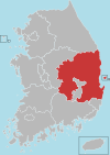
 Location in South Korea | |
| Country | |
| Region | Yeongnam |
| Administrative divisions | 1 eup, 17 myeon |
| Area | |
• Total | 1,175.89 km2 (454.01 sq mi) |
| Population (2002) | |
• Total | 71,216 |
| • Density | 60.6/km2 (157/sq mi) |
| • Dialect | Gyeongsang |
Uiseong County (Uiseong-gun) is a county in Gyeongsangbuk-do Province, South Korea. Located near the center of the province, it is bounded by Andong on the north, Cheongsong on the east, Gunwi County on the south, and Sangju and Yecheon on the west. As in most parts of Korea, most of the land is vacant and forested; only about 19% of the county's area is farmland. The county is largely rural, with an economy dominated by agriculture; the only urbanized area is the county seat, Uijeong-eup.
South Korean national treasure 77, a five-storied stone pagoda, lies in Geumseong-myeon. Also in Geumseong-myeon are a set of more than 300 dinosaur tracks from the early Cretaceous period.[1]
Uiseong is home to Gounsa, one of the 24 head temples of the Jogye Order of Korean Buddhism. This temple is located in Danchon-myeon.
Famous people from Uiseong include Yu Seong-ryong, provincial commander during the Japanese invasions of Korea (1592-1598).
Administrative divisions
Uiseong County is divided into 18 primary districts (1 eup and 17 myeon). These in turn are divided into 178 legal ri, which in turn are composed of a total of 399 administrative ri. The county's primary divisions are as follows:
 |
Climate
| Climate data for Uiseong (1981–2010) | |||||||||||||
|---|---|---|---|---|---|---|---|---|---|---|---|---|---|
| Month | Jan | Feb | Mar | Apr | May | Jun | Jul | Aug | Sep | Oct | Nov | Dec | Year |
| Mean daily maximum °C (°F) | 4.3 (39.7) |
7.1 (44.8) |
12.6 (54.7) |
20.1 (68.2) |
24.8 (76.6) |
28.1 (82.6) |
29.9 (85.8) |
30.6 (87.1) |
26.3 (79.3) |
21.1 (70.0) |
13.6 (56.5) |
7.0 (44.6) |
18.8 (65.8) |
| Daily mean °C (°F) | −3.5 (25.7) |
−0.8 (30.6) |
4.7 (40.5) |
11.5 (52.7) |
16.8 (62.2) |
21.2 (70.2) |
24.5 (76.1) |
24.8 (76.6) |
19.4 (66.9) |
12.3 (54.1) |
5.0 (41.0) |
−1.2 (29.8) |
11.2 (52.2) |
| Mean daily minimum °C (°F) | −10.0 (14.0) |
−7.6 (18.3) |
−2.4 (27.7) |
3.1 (37.6) |
8.8 (47.8) |
14.8 (58.6) |
20.0 (68.0) |
20.2 (68.4) |
14.1 (57.4) |
5.5 (41.9) |
−1.7 (28.9) |
−7.6 (18.3) |
4.8 (40.6) |
| Average precipitation mm (inches) | 18.0 (0.71) |
24.8 (0.98) |
41.5 (1.63) |
65.9 (2.59) |
78.3 (3.08) |
132.0 (5.20) |
231.2 (9.10) |
230.0 (9.06) |
131.7 (5.19) |
31.7 (1.25) |
31.5 (1.24) |
15.2 (0.60) |
1,031.7 (40.62) |
| Average precipitation days (≥ 0.1 mm) | 4.3 | 5.2 | 6.9 | 7.1 | 7.8 | 8.8 | 13.3 | 12.6 | 8.4 | 4.8 | 5.2 | 4.5 | 88.9 |
| Average relative humidity (%) | 66.6 | 64.3 | 63.1 | 58.7 | 62.6 | 67.4 | 75.5 | 75.8 | 75.7 | 73.0 | 71.4 | 69.2 | 68.6 |
| Mean monthly sunshine hours | 177.9 | 177.7 | 200.7 | 222.2 | 235.4 | 201.0 | 161.9 | 174.9 | 159.5 | 187.3 | 162.5 | 169.6 | 2,231.2 |
| Source: Korea Meteorological Administration[2] | |||||||||||||
Twin towns – Sister cities
Uiseong is twinned with:
See also
References
- ^ Uiseong Dinosaur Tracks | North Gyeongsang Province | South Korea
- ^ "평년값자료(1981–2010) 의성(278)". Korea Meteorological Administration. Retrieved 2011-05-02.


