Upper Tract, West Virginia
Appearance
Upper Tract | |
|---|---|
 Corn fields with Upper Tract in the back | |
| Country | United States |
| State | West Virginia |
| County | Pendleton |
| Elevation | 1,558 ft (475 m) |
| Time zone | UTC-5 (Eastern (EST)) |
| • Summer (DST) | UTC-4 (EDT) |
| GNIS feature ID | 1555861[1] |
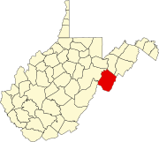
Upper Tract is an unincorporated community located in Pendleton County, West Virginia, United States.[1] The community lies along U.S. Highway 220 at the confluence of Reeds Creek and the South Branch Potomac River.
Two local structures — the Cunningham-Hevener House and the Pendleton County Poor Farm — are listed on the National Register of Historic Places.[2]

