Vergt
Vergt | |
|---|---|
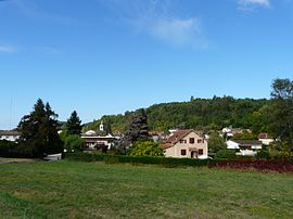
 A general view of Vergt | |
| Coordinates: 45°01′41″N 0°43′09″E / 45.0281°N 0.7192°E | |
| Country | France |
| Region | Nouvelle-Aquitaine |
| Department | Dordogne |
| Arrondissement | Périgueux |
| Canton | Périgord Central |
| Intercommunality | Le Grand Périgueux |
| Government | |
| • Mayor (2020–2026) | Pierre Jaubertie[1] |
| Area 1 | 32.52 km2 (12.56 sq mi) |
| Population (2021)[2] | 1,731 |
| • Density | 53/km2 (140/sq mi) |
| Time zone | UTC+01:00 (CET) |
| • Summer (DST) | UTC+02:00 (CEST) |
| INSEE/Postal code | 24571 /24380 |
| Elevation | 112–246 m (367–807 ft) (avg. 126 m or 413 ft) |
| 1 French Land Register data, which excludes lakes, ponds, glaciers > 1 km2 (0.386 sq mi or 247 acres) and river estuaries. | |
Vergt (French pronunciation: [vɛʁ]; Occitan: Vern) is a commune in the Dordogne department in Nouvelle-Aquitaine in southwestern France.
History[edit]
On 9 October 1562, Vergt was the site of one of the first major battles of the French Wars of Religion. An army of Huguenot rebels under Symphorien de Duras was defeated by a Royalist force led by Blaise de Montluc, a victory which prevented them linking up with Protestant forces north of the Loire.[3]
Population[edit]
| Year | Pop. | ±% |
|---|---|---|
| 1962 | 1,190 | — |
| 1968 | 1,224 | +2.9% |
| 1975 | 1,369 | +11.8% |
| 1982 | 1,419 | +3.7% |
| 1990 | 1,422 | +0.2% |
| 1999 | 1,514 | +6.5% |
| 2008 | 1,748 | +15.5% |
See also[edit]
References[edit]
- ^ "Répertoire national des élus: les maires" (in French). data.gouv.fr, Plateforme ouverte des données publiques françaises. 13 September 2022.
- ^ "Populations légales 2021". The National Institute of Statistics and Economic Studies. 28 December 2023.
- ^ Thompson 1909, p. 157.
Sources[edit]
- Thompson, James (1909). The Wars of Religion in France 1559–1576: The Huguenots, Catherine de Medici and Phillip II. Chicago University Press.
Wikimedia Commons has media related to Vergt.


