
Victor, Montana
Victor, Montana | |
|---|---|
 Location of Victor, Montana | |
| Country | United States |
| State | Montana |
| County | Ravalli |
| Area | |
| • Total | 1.6 sq mi (4.1 km2) |
| • Land | 1.6 sq mi (4.1 km2) |
| • Water | 0.0 sq mi (0.0 km2) |
| Elevation | 3,415 ft (1,041 m) |
| Population (2000) | |
| • Total | 859 |
| • Density | 537.6/sq mi (207.6/km2) |
| Time zone | UTC-7 (Mountain (MST)) |
| • Summer (DST) | UTC-6 (MDT) |
| ZIP code | 59875 |
| Area code | 406 |
| FIPS code | 30-76900 |
| GNIS feature ID | 0792701 |
Victor is a census-designated place (CDP) in Ravalli County, Montana, United States. The population was 859 at the 2000 census.
Geography
Victor is located at 46°25′2″N 114°8′58″W / 46.41722°N 114.14944°WInvalid arguments have been passed to the {{#coordinates:}} function (46.417213, -114.149547)Template:GR.
According to the United States Census Bureau, the CDP has a total area of 1.6 square miles (4.1 km²), all of it land.
Demographics
As of the censusTemplate:GR of 2000, there were 859 people, 351 households, and 230 families residing in the CDP. The population density was 537.6 people per square mile (207.3/km²). There were 375 housing units at an average density of 234.7/sq mi (90.5/km²). The racial makeup of the CDP was 96.16% White, 0.12% African American, 1.51% Native American, 0.12% Pacific Islander, 0.70% from other races, and 1.40% from two or more races. Hispanic or Latino of any race were 2.56% of the population.
There were 351 households out of which 34.5% had children under the age of 18 living with them, 50.1% were married couples living together, 10.0% had a female householder with no husband present, and 34.2% were non-families. 27.1% of all households were made up of individuals and 9.1% had someone living alone who was 65 years of age or older. The average household size was 2.45 and the average family size was 2.97.
In the CDP the population was spread out with 29.2% under the age of 18, 7.2% from 18 to 24, 27.5% from 25 to 44, 21.0% from 45 to 64, and 15.1% who were 65 years of age or older. The median age was 35 years. For every 100 females there were 90.9 males. For every 100 females age 18 and over, there were 90.6 males.
The median income for a household in the CDP was $38,618, and the median income for a family was $42,986. Males had a median income of $29,917 versus $17,250 for females. The per capita income for the CDP was $17,599. About 6.6% of families and 7.7% of the population were below the poverty line, including 14.0% of those under age 18 and none of those age 65 or over.
Notable residents
- Tom Hewitt, actor
References
External links
Municipalities and communities of Ravalli County, Montana, United States | ||
|---|---|---|
| City | 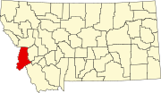 | |
| Towns | ||
| CDPs | ||
| Other communities | ||